Special Edition


Furuno NavNet TZtouchXL range: excellence for navigation and fishing

Safety at sea: what reflexes should yachtsmen adopt in the face of modern piracy?

B&G Zeus SR: a fast, ergonomic chartplotter designed for sailing
Boating license
Why is the Mercator map essential for understanding longitude and latitude?

A transatlantic race without autopilot or windvane gear aboard a 10-metre sailboat

How to follow the Vendée Globe finishes: practical tips and information

D+22 Vendée Globe 2024, where do the sailors stand? New record at Bonne Espérance in Figaro mode

End of an era: Imray discontinues paper charts in 2025

In the eye of the whirlpool: understanding maelstroms for safe sailing

Lowrance expands its Elite FS range with 10" and 12" displays

Junks: a multi-faceted nautical heritage

Antsiva: a multi-purpose schooner for oceanographic research and pleasure boating

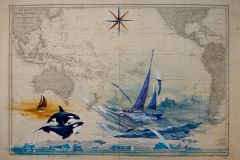
"Un Trésor à la Carte": when art and the sea meet for a cause of solidarity

C-MAP map enhancements for inland and coastal waters in Europe

Mercury 150 R, a racing outboard that plays it safe

Lowrance introduces Eagle Eye, an all-in-one live sounder for amateur and hobby anglers

Modélisme Naval Hermanville: historic ship reproductions in miniature

Enjoy water sports while preserving coastal biodiversity with C-monspot.fr

Platypus Spearfish, a catamaran to enjoy the pleasures of the sea and the underwater world

The essentials to prepare your rental cruise
Test
Merry Fisher 1295 Fly, interior and exterior design maximized

Isles of Scilly: How to prepare for navigation in the archipelago: Formalities, landing, shelter

Deciphering the mysteries of the Carta Marina and its medieval sea monsters

10 Tips for Buying Used Marine Electronics for your boat and save money

C-MAP announces major European mapping update for 2024

ScanNav is a scalable solution for all the navigation and routing needs of yachtsmen
Equipment Weekly
3 new on-board electronics for our boats

Integrating Furuno fishfinders into the TZ iBoat mobile application
Boating license
Where are the longitude lines on my map?

Divazur: The specialist in underwater scooters for turnkey watertoys on your boats
Boating license
When I arrive in port at night, what color lighthouse will guide me?

Yamaha boosts its V6 engine range with 350 hp

NSX Ultrawide, a panoramic display now available from Simrad

Update the nautical chart with bearings

Transformations on a Sun Odyssey 479 to go from cruising to racing

Naviguer sur les sentiers du vent: A poetic stroll exploring our connection to the sea

Cartes marines: An artistic and poetic book about France

Nautical wrecks: CERES between preservation and salvage control

Why are Class40s that reach Lorient by truck still allowed to take part in the Jacques Vabre?
