Every week, we present you with a question about your boating license. To help you validate your knowledge, or to discover new and unexplored areas. This week, we tackle a question on cartography.
A trick question...
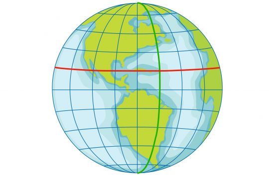
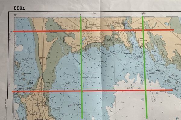
Meridians are vertical lines running from the North Pole to the South Pole. Meridians are "lines of longitude", with all points on them having the same longitude. When transcribed flat, they are therefore vertical lines, shown in green in our example.
The horizontal lines, the best-known of which is the Equator, are the lines of latitude, also known as the Parallels. All points have the same latitude.
But there's a catch: on a vertical line, you'll read the latitude scale. Thus, the Equator will be the zero point of a vertical line. It's this vertical scale that we'll use to read the latitudes.
But the vertical line connecting the 2 poles is a line of longitude, or a Meridian.
Beware of confusion
Parallels, which represent latitudes, are horizontal lines. The common mistake could be attributed to the learning, which is correct, that the vertical graduation on a map indicates latitude. In fact, this vertical graduation helps locate the position of a horizontal line, i.e. the parallel, which determines latitude.

 /
/ 