A little history
Traditionally, the Ponant refers to the western cardinal point, as opposed to the Levant. The term ponant, reminds us of the side on which the sun "sets" (pontiff for the emeritus Latinists).
By extension, for a long time, sailors used the word ponant to name the Atlantic Ocean. Conversely, the east was the Mediterranean. In the past, sailors even talked about the ports of Ponant such as Brest or La Rochelle and the ports of Levant such as Marseille or Sète.
This is how, by analogy, the sailors criss-crossing the Mediterranean Sea named the wind coming from the west as the ponant.
The characteristics of the ponant
The ponant is a westerly wind, it is often associated with a southerly component. This wind is rather mild, especially if it blows from the southwest.
It can blow with some vigour on the Balearic Sea, but in general the ponant from west to southwest leaves the Gulf of Lions quite windy.
This wind can be encountered all year round, but it is mostly observed in spring and autumn.
In summer, it can have similar characteristics to the thermal breeze with which it can merge at the end of the day.
How is Ponant? formed?
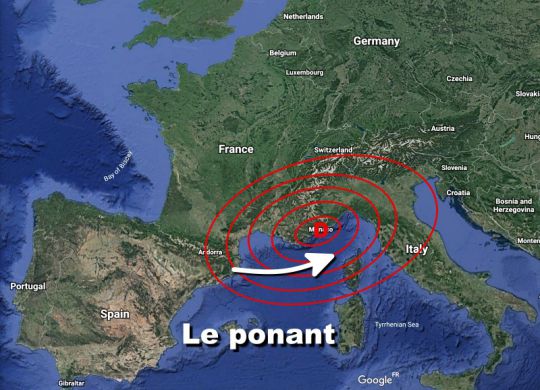
The Ponant may wake up in the event that a depression deepens south of the Alps or on the Po plain, located in northern Italy. This low generates a "rise" of Mediterranean air which characterizes the ponant as well as the Libeccio (SW wind operating in the north of Corsica).
The ponant is generally associated with Libeccio and can precede the Mistral and the tramontane if a high pressure centre is well established in the Bay of Biscay.
Pressure differences will have to be monitored to assess its strength: a difference of 5 hPa or more between the Ligurian Sea and the Balearic Sea should alert sailors to the risk of a strong wind.

 /
/ 

