Regular AIS messages
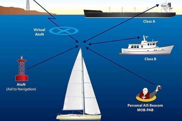
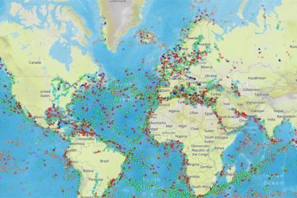
AIS messages are short and frequent. They contain data on the vessel and its navigation. These messages are transmitted every 2 to 6 seconds by the AIS transponder, depending on its class, and received by all ships and coastal stations equipped with an AIS receiver. They can be processed by specific software and displayed on a screen or electronic chart. The system operates in both ship-to-ship and ship-to-shore modes.
The range of AIS signals depends on antenna height and weather conditions. Typical ranges are 7 to 8 miles for pleasure craft, 15 to 20 miles for merchant navy vessels, and 40 to 60 nautical miles for land stations.
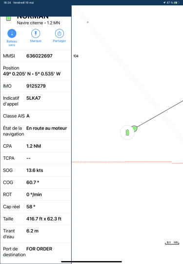
What information does AIS transmit and receive?
AIS transmits a wide range of information. These include the ship's name, IMO (International Maritime Organization) number, MMSI (Maritime Mobile Service Identity) number, type (cargo, tanker, passenger...), GPS position, course, speed and heading, destination, cargo... This data falls into three main categories:
- Statistical information. This includes the ship's identity: MMSI (Maritime Mobile Service Identity) number, name, call sign, IMO (International Maritime Organization) number if available, type (cargo, tanker, passenger, pleasure...).
- Dynamic information such as the ship's position, GPS coordinates (latitude and longitude), true course and compass heading, bottom speed and surface speed.
- Route-related data such as the vessel's destination, estimated time of arrival, rudder angle, navigational status (stationary, underway, at anchor, etc.), draught.
Interpreting AIS data
Some GPS data, such as CPA and TCPA, can be of real interest for safety, if you know how to analyze them properly.
CPA stands for Closest Point of Approach. It is calculated by the AIS and indicates the minimum distance two vessels will approach each other if they maintain their current course and speed. CPA thus enables the risk of collision to be assessed, and appropriate measures to be taken to avoid it.
The CPA is often accompanied by the TCPA, or Time to Closest Point of Approach, which indicates the time remaining before the two vessels reach the CPA. CPA and TCPA are displayed on the AIS or GPS plotter screen, and can be configured to trigger an audible or visual alarm if the values fall below a predefined threshold.
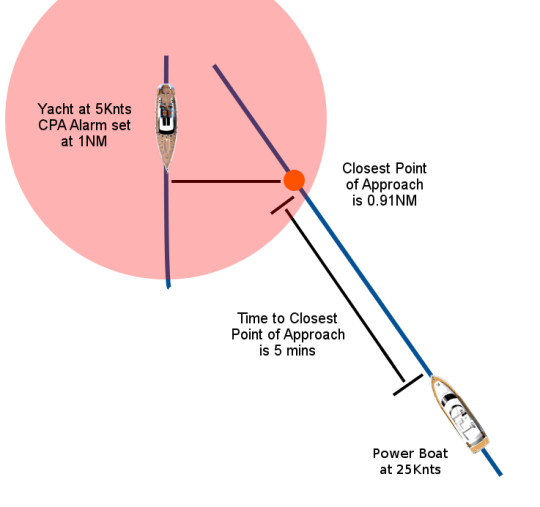
CPA and TCPA are useful data for safety at sea, but should not be considered as 100% reliable information. They are based on data transmitted by the AIS, which may be erroneous, incomplete or obsolete. In addition, they do not take into account environmental factors such as wind, currents or swell, which can alter a vessel's trajectory. We must therefore always be vigilant and use common marine sense, and not rely solely on AIS data to avoid collisions
SOG ( Speed Over Ground) is a much more traditional form of data. This is the ship's speed relative to the ground, measured by GPS. It may differ from speed over water, which depends on current and wind.
COG, Course Over Ground. This is the ship's direction in relation to true north, measured by GPS. It may differ from the course relative to magnetic north, which depends on magnetic declination. COG and true course may differ if the ship is drifting due to current or wind, or if magnetic declination is high.
ROT, Rate Of Turn. This is the angular speed of the ship as it changes course, measured in degrees per minute. It indicates whether the vessel is turning right or left, and at what speed.
AIS is therefore a system that enhances communication between vessels, which can identify each other and share their position, speed and course information. But we must be careful not to rely solely on AIS data, which can be faulty, incomplete or biased. We must therefore always be attentive and responsible, and not rely solely on AIS data to ensure safety at sea.

 /
/ 