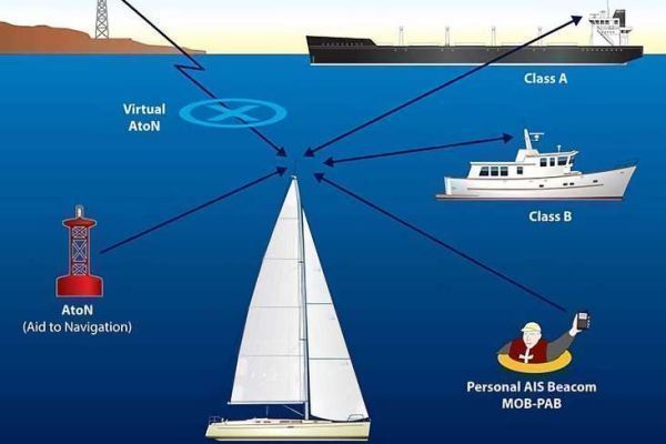
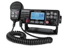
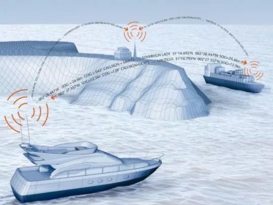
AIS, or Automatic Identification System, is a device that enables boats to identify themselves and share their position, speed and course information with other boats and coastal stations within VHF range. It thus helps prevent collisions at sea and tracks the fleet in real time.
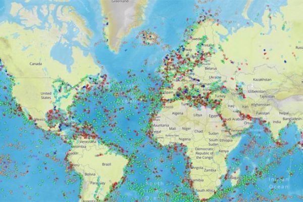
But how can we view AIS-equipped boats on land where we're out of VHF range? There are specialized websites, such as Marine Traffic or Vessel Finder, which display boat positions on an interactive map. These sites are based on AIS data collected by land and satellite stations, which receive the signals emitted by the boats and transmit them to the servers.
Data reliability
But can we trust websites that display the positions of AIS-equipped boats on an interactive map? Not necessarily. In fact, these sites are based on AIS data collected by land stations, which receive the radio signals emitted by boats and transmit them to servers via the Internet.
It's so powerful that it can sometimes play tricks. However, the system is not infallible. There can be failures at various levels: the boat's AIS transmitter, the boat's VHF antenna, the land station, the internet connection, the website... or simply the lack of a land station able to receive the AIS message.
However, these land stations are neither numerous nor reliable enough to cover the entire French coastline. France's coastline stretches for around 1,900 nautical miles (3,500 kilometers), whereas the range of an AIS is around ten miles at best. To receive and relay all AIS messages, at least 190 stations would need to be operational and connected to the Internet. But this is not the case.
The range of AIS signals is limited by the height of the antennas and the curvature of the earth. A boat equipped with AIS may therefore not be visible on the Internet if it is too far from a land station, or if there are obstacles, such as heavy swells, between it and the station. What's more, even though AIS is being used by more and more boats, including pleasure craft, there are still many that don't have it on board. So what you see on the chart represents only a fraction of the total number of boats. So be careful when using this type of application for navigation.
How to read Marine Traffic data
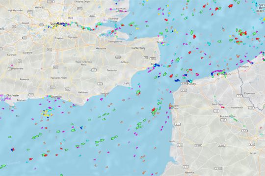
On the map, boats are represented by icons of different shapes and colors, depending on their status and type. Boats in motion are triangles pointing in the direction they are moving. Boats at a standstill or slow speed are represented by circles. The colors indicate the type of boat: cargo, tanker, passenger, pleasure... For example, pleasure boats are pink.
Hovering the mouse over an icon displays the boat's name, speed and course. Clicking on an icon takes you to the boat's data sheet, with photo if available.
With the search engine, you can also locate boats by typing their name. It's a great way to keep track of your friends or competitors as they sail.
AIS is therefore a system that enhances safety at sea, but is not infallible on the Internet for use at sea. Nonetheless, these free-access sites provide a welcome break for seasick landlubbers!

 /
/ 