A community coastal guide
Navily is a collaborative app launched in 2015 that helps boaters manage their moorings and stops. This community coastal guide - contraction of The Navigation Family - was born from the idea that boaters form a big family and only need a tool that allows them to share their experience. Today Navily gathers a community of over 700,000 users and is available in 5 languages.
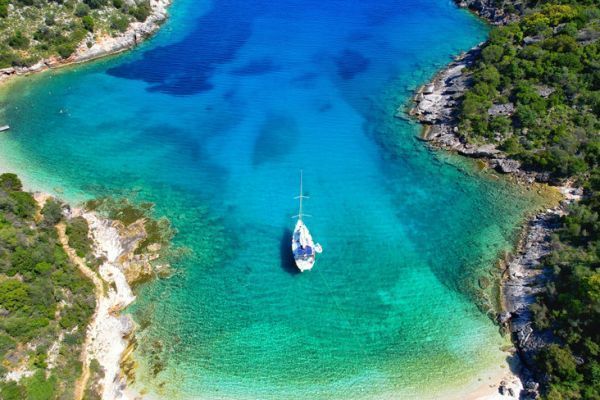
At the heart of the application is a guide that references nearly 30,000 anchorages and ports in Europe and the Caribbean, thanks to users. Users share a lot of information, advice and good tips, all of which are enhanced by opinions, comments and photos, making life easier for everyone: type of bottom, orientation, nearby services, pitfalls to avoid, where to tie up your dinghy, how to avoid a shoal, where to eat...
Each user can reference an anchorage or a port and add their opinion. Thus, more than 120,000 comments and nearly 80,000 photos have been added concerning the 12,000 ports and marinas and the 18,000 anchorages. The comments are regularly updated, as proof, almost half of the content has been added in the last 12 months. It is not uncommon to see a profile of a mooring that a user visited and rated less than a week ago, a reassuring feature for boaters.
Reserve a berth in one of the 600 partner ports
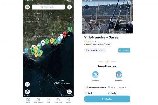
In the second year of development, the application was equipped with a reservation system for marinas . Finding a berth can be tricky, especially during the summer, and can be a source of stress. From the application, boaters can contact one of the 600 partner harbors to book their night thanks to a system with a simple bank imprint and by sharing their profile (type of boat, dimensions...). They then receive a price proposal from the port.
Like the anchorages, each port has a card answering 5 criteria: reception, cleanliness, services, shops and tourist interest. Each card also has photos and users can exchange opinions and comments.
Find nearby boaters and help each other
Via the application, it is also possible to help each other in real time. Thanks to a geolocation system, it is possible to discover nearby sailors and to exchange with them via messages. It is easy to find out about the quality of a mooring or the availability of places in a port. Users can also add jellyfish or weather alerts for example. The SOS function also allows users to request help from nearby boats.
A premium subscription to make navigation even easier
The entirely free application also offers a premium subscription to access additional features:
- Download certain areas to your phone in offline mode,
- A mode for calculating the route between two automatic points with waypoints and the course to follow
- Select a mooring according to precise criteria (beach, western protection...)
- Weather predictions for wind and swell protection for up to 72 hours
The weather service and the Navily Score
In the free version, the user only has access to the past and current conditions of a mooring. In the premium version, forecasts are extended to 72 hours with steps of 3 hours.
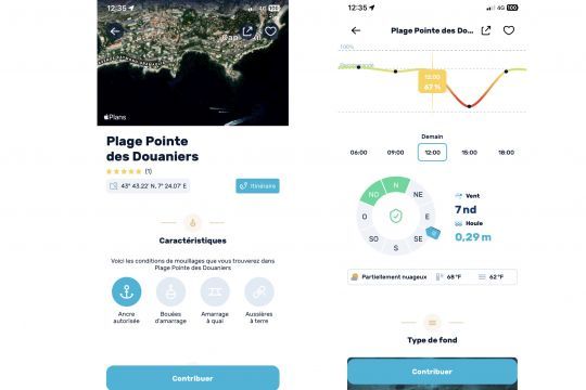
When a user adds an anchorage, he/she must describe the protection of the anchorage by selecting sections on the wind rose. He can then define that an anchorage is protected from North, North East and East for example. Since 2020, the application has evolved to combine protection and weather forecasts. Today, a system automatically calculates a recommendation score by taking into account all the weather data available to the application and compares it with the protection offered by the anchorage: wind speed and gusts, swell height, wind and swell angle... For each anchorage, the system compares all this information and determines a recommendation score between 0 and 100 for each forecast. Premium users then have access to a graph that shows how the anchorage will evolve over the day, night and the following days.
The objective is to facilitate the choice of a mooring to the yachtsman, without him having to estimate the future conditions.
A new feature, discover the local shops
Users now have the possibility to add businesses in ports and anchorages: boathouse, supermarket, pharmacy, doctor, mechanic, electrician, hairdresser, bar, restaurant... Each business can be illustrated with photos and comments. As a large community, boaters often encounter the same issues and like to have opinions shared by others. Beyond our French coasts, the tool becomes even more useful in less touristic areas or for more technical information: how to find a place to declare your entry or exit of the territory in Greece, Croatia or the Caribbean, where to find a good mechanic, a good hardware store?
Friends boaters, we count on you to share your good plans and your photos!
