Helping boaters find anchorages outside the sea grass beds
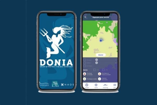
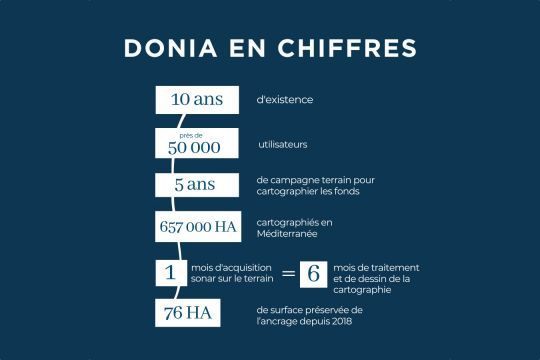
Launched in 2013, the Donia mobile application is a solution to help anchor outside fragile ecosystems. Developed by Andromède Océanologie, Donia offers a mapping of the Mediterranean seabed, and in particular the critically endangered Posidonia meadows, but also the sandy or rocky-coralligenous seabed. After 10 years of existence, nearly 50,000 users have downloaded the application to anchor in a more ecological way, without damaging the underwater grasses.
657,000 hectares mapped and regularly updated
Via Donia, the user discovers the position of his boat on a simplified cartography of marine ecosystems. He can choose his anchorage on sandy bottoms, in order to preserve the endemic and protected Mediterranean species. In total, 657,000 hectares have been mapped in the Mediterranean, over a total of five years of sea campaigns combining sonar imagery and underwater dives.
The maps are regularly updated as Agathe Blandin, in charge of mapping at Andromeda Oceanology, explains: "Mapping is done through data acquisition in the field. I analyze the data we've collected in the field, then draw it freehand with a graphics tablet and upload it to the app. This constitutes a base that we consult before each outing to know the areas to be updated. These are often areas that are very damaged by boat anchors. This allows us to see if there is a recolonization or if an anchor continues to damage the meadows. Upstream of the field part, we use a lateral sonar, which is a kind of cylinder, which is towed behind the boat and sends acoustic waves on the sea bed. This tool sends back a yellow and white image and allows me to make a map. As an example, on a small but rather complex area of 5 kilometers by 5 kilometers, it can take me 3 to 4 days of mapping work. To gather all the data that are geo-referenced, we use a mapping software and e nsuite 3/4 of the work is done on Photoshop to image the map."

Conclusive results on the protection of Posidonia
Andromède Océanologie indicates that it has compared the anchorages made with the application and those of non-user boats over a period of 5 years. The result is rather conclusive, since the organization says it has avoided the destruction of 76 hectares of Posidonia thanks to the application.
Share observations on your moorings
The application also allows you to share many observations, as Thomas Bockel, marine environment researcher at Andromeda Oceanology, explains: "Users can enter information when they have observed, for example, a bay with a lot of anchorages, accidental pollution, a particular dive, if they have observed a specific fish species, etc. All these data allow us to draw up participatory maps, whether of species occurrences or pressures observed. All these data allow us to draw up participatory maps, whether it is the occurrence of species or the pressures observed. Donia is enriched with scientific data from Andromeda Oceanology, but the application also provides feedback from users."
Alternative moorings for yachts over 24 m
The anchoring of boats can generate a lot of damage on the sea bed, especially for heavy tonnage boats. In Golfe-Juan, 100 hectares of sea grass beds have been destroyed in ten years. Thus, since 2019, boats over 24 m are prohibited from anchoring on Posidonia meadows.
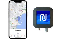
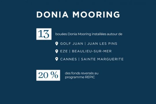
To accompany the legislation, Donia Mooring allows to reserve mooring buoys without impact on the seabed for yachts from 24 to 70 m. These coastal buoys benefit from several services such as mooring assistance and household waste collection. 20% of the profits collected are donated to the Donia Repic Posidonia Restoration Program.
To encourage users, several buoys will be deployed on the French Riviera, increasing from 6 to 13.
Replanting devastated seagrass beds
One of the other developments initiated by Andromeda Oceanology is the Donia Repic program. This is a program of ecological restoration of seagrass beds. Biologists re-implant fragments of seagrass beds on dead areas that are not allowed to be anchored. The survival rate of these "new plants" is now 70 to 80% and aims to accelerate the natural recovery of marine plants. The next Repic session is scheduled for the summer of 2023.

 /
/ 