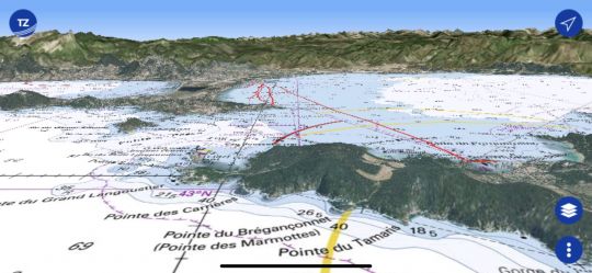
TZ iBoat is an application developed by Timzezero (Maxsea) for iPad and iPhone. It uses the same graphics engine used on PCs, which is characterized by an incredible fluidity and an ultra fast display speed (sometimes even too fast!). This ease of use can be found on his mobile with TZ iBoat. The vision in 2D, but also in 3D (where you can see the relief) is also available.
But what doesn't TZ iBoat do?
When we discover the possibilities of TZ iBoat, we wonder about the interest of Timezero on PC... In fact, TZ iBoat only lacks the routing (forecasting a route based on weather data) for this application to be really complete. But no doubt that this feature, which has been the master feature of Maxsea since its origins, should be implemented in a future version (but we didn't tell you...).
An all-in-one application
When cruising, we often use several applications to meet our needs: cartography to navigate and weather data for navigation. TZ i Boat brings all these uses together in the same application.
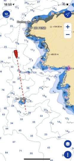
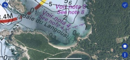
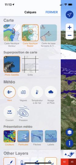
Thus one can display (successively) the Raster chart (paper chart), the vector chart, the overlay of satellite images, the weather.
The card module
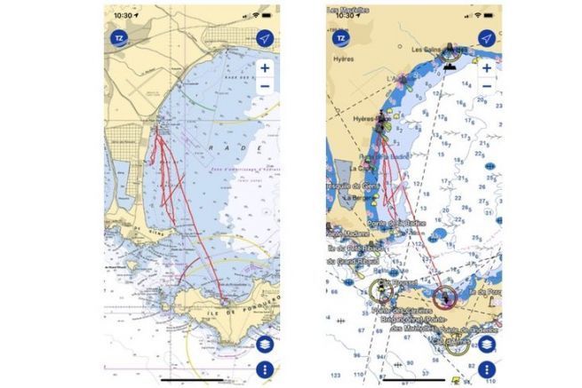
TZ iBoat offers to display the Raster map (photo of paper maps). This is very useful, because vector maps allow you to zoom in so much that you lose the accuracy of the maps. It's very useful when you're doing some rocky terrain, but the Raster view reminds you that the accuracy of the maps is not as accurate as that of our GPS.
The vector chart used is a C-Map chart, but some information is taken from official S-52 charts. The management of these two models is not well taken into account, since it is not always clear where to set the display modes for either of these data. A single menu would be more efficient.
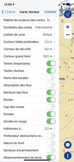
As with all vector mapping, TZ iBoat gives you the choice of displays with a large number of settings that require you to clear the land at first to get "his map".
The very fine weather
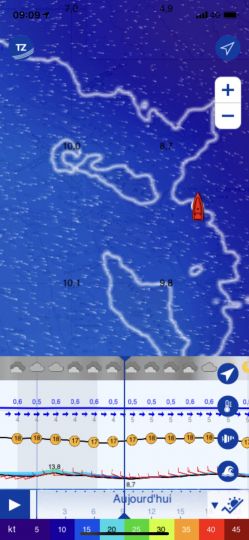
The basic weather data is taken from the free GFS files. But it is possible to take subscriptions to have more precise data, like Arome for example. The interest of the application lies in this really powerful weather module. You can choose your display mode (in color, with barbules, with numerical data, or all 3!) And you can follow the evolution of the wind, waves or even isobaric maps.
But we really liked the meteorographer, which gives us a good view of the coming weather in a single view. This is particularly useful when cruising when you're at anchor and want to know how the weather is going to develop for the night.
Funny note, TZ iBoat allows you to see the weather for the previous days. I'm not sure how useful this can be, but it's the only application I know that offers this feature. Maybe it can be used for an insurance report to show the conditions at the time of the event?
How much does it cost?
The application that only works under iOS (no development planned under Android) is free. It is the subscription to the maps that is paid. Charge between 30 and 60 euros/year for a navigation zone. Raster charts being separated from vector charts. In addition, to have a more accurate weather forecast, you have to take the premium subscription of 10 euros/month. This gives access to 5 high resolution weather models: Arpège, Arome, DWD ICON, NAM Conus and Copernicu for a worldwide coverage.
AIS and Radar modules also allow to display these data if connected to a Wifi router on board.
Our opinion
After several weeks of testing, we have fully adopted this application. The ability to juggle between the different card models (at lightning speed) is an advantage when looking for a small anchorage. The weather forecast with its different displays is also very easy, fun and efficient. There are still a few settings to be found (which we hope will come in future versions) such as obtaining a clear map where important navigational details are well highlighted.
Compared to the Navionics application we are used to using, TZ iBoat seems much more complete and much more comprehensive. The only good thing about Navionics is the very clear display of its vector map. But no doubt after a few adjustments, TZ iBoat should achieve the same result.
The fact remains that sailing in your area for just under 100 euros with all the detail charts and weather will always remain an unbeatable offer compared to a PC application, a dedicated chart plotter or simply paper charts!

 /
/ 