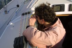
Julie Le Coz is a geomatician and has been a civilian technician for the past ten years with the French Navy's Hydrographic and Oceanographic Service - SHOM. Under the word " geomatics in fact, two concepts that are well known to everyone are "geography" and "computer science".
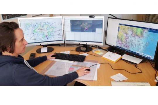
At the crossroads of an age-old know-how and a modern tool
Geography or the art of writing the terrain. Whether through maps, sketches or aerial or satellite photographs, the terrain, i.e. the planet Earth, is represented in its quasi-totality by geography.
Computer science adds a dose of intelligence to the linking of these various elements within gigantic databases, integrating among others: satellite photos, field surveys...
Julie's job is to make computers talk so that they provide correct and usable information. By training, Julie is a geographer in coastal area management and has added a technical specialization in geomatics. She was first a civil hydrographic geomatician as a sailor, therefore on board.
Coastline specialist
Julie Le Coz's specialty is the coastline. She explains its importance. " At Shom, navigation safety is an imperative! This is why an accurate and up-to-date knowledge of the coastline is the preamble to any chart creation. A navigator must be able to have full confidence in his chart, in order to plot his route with complete peace of mind."
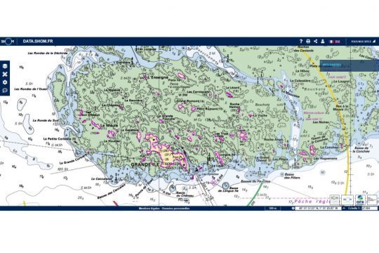
The specialist explains, " The project to revise the land-sea boundary, which is now the official name for the coastline, came about in 2014. The previous surveys were from the early 2000s and the accuracy was no longer sufficient. The maps were updated but there was no reference database. In 2000, Histolitt coastline ( TCH ) was created between the SHOM and the IGN . Not very precise, it had become obsolete on certain zones, sometimes incomplete and, thus, did not answer any more to the actors of the littoral. The Xynthia storm highlighted the lack of a reference coastline, and led to an awareness of coastal public actors on the need to protect the coastline against the retreat of the coastline or the risk of marine submersion. "
A huge gain in precision and little smoothing.
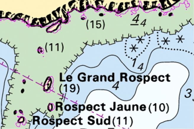
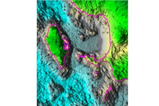
The TCH available until then offered an accuracy of the order of sometimes several tens of meters. The geomatician emphasizes the gain. " Many areas were smoothed out when more precise information was not available. The new land-sea boundary is accurate to an average of 2 meters. It contains almost no smoothing and thus keeps a maximum of details. Only the port infrastructures have been cleaned in order to have the cleanest rendering possible. "
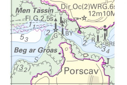
" The data that feed the database come from both public administrative institutions - EPA, Shom and IGN, for the crossing and enrichment of the data, or from other public organizations for the attribution of the final data. "It is out of the question that anyone who does not have the authority to add to or modify a statement made with state-of-the-art tools.
The source of the data determines its accuracy
Like any mathematical model, the more precise the source, the better the result. Julie specifies her sources. " Two essential data were taken into account in the foreground. A MNT, Digital Terrain Model, litto3d which allowed to know the relief of the foreshore. Then the surface of the tide PHMA or Highest Astronomical Seas. It is the intersection of these two pieces of information that drew the contours of the land-sea limit. "
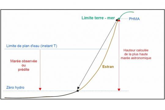
DTM, tide, and other data helped refine this boundary to answer a simple question, where does the sea end and the land begin.
An important problem, how high will the sea rise?
The question is not as trivial as that. It concerns the knowledge of the highest point where the sea will rise according to the context and circumstances. The limit established is that of the PHMA at the coefficient 120 and at the average pressure of 1015 hectoPascals, that is to say the Atmospheric Pressure, and in the absence of offshore wind.
The specialist adds, " It was necessary to create a unique reference system so that everyone could talk about the same thing ". This reference limit may become an administrative limit for the maritime police, a cadastral limit for the equipment or even a fishing zone limit.
Challenging customs and habits
This new reference system has called into question many practices that, over the years, had become habits, nibbling away at a few meters of coastline here and there. " In this sense, the land-sea boundary provides a new tool for the public actors of the coastline ".
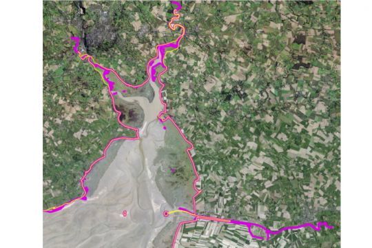
Thus, the municipalities now have a clearer and more precise reading of their public maritime domain and of those boaters who may or may not have to pay occupation taxes.
Julie Le Coz insists on knowledge of the environment. " The implementation of this new land-sea boundary is an unprecedented opportunity to offer users a better knowledge of their environment. Thus, more than 5,000 launching structures have been identified. From simple slipways to ferry piers, we now have a much more exhaustive vision of the means of access to the sea from land. "
Open and updated database
In application of the French government's Open Data policy, non-strategic data are available in Open Data for all users. For example, a sea kayaking association can add buoys to which kayakers can moor to land. Or a boating association can superimpose on the land-sea boundary the buoys available to its members.
The specialist concludes, " The database that the SHOM now makes available is not fixed at a time "T" but the coastline continues to evolve. This is why updating occurrences are still under consideration, perhaps every 5 to 10 years to take into account the increased accuracy of the survey tools . We only cover metropolitan France for the moment, the production in overseas is under consideration and the database is updated continuously within the SHOM. "
Uses to be invented
More than marine cartography, Open Data inscribes the land-sea boundary in the uses to be invented by users, operators, media as well as all the actors of the maritime world to enrich a little more the information provided to the general public.
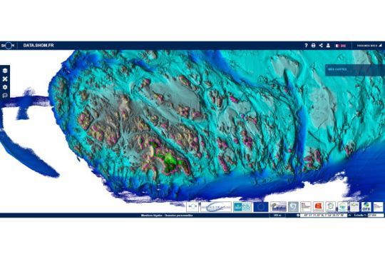
At random, the location of lifebuoys, heliports, SNSM stations or even the landing of submarine cables would be of interest to the entire nautical community, including boaters and fishermen. All of these uses, and no doubt many others, are left to the care of the users by the SHOM. The latter is limited to providing this new boundary of our territory and, via the data portal, the standardized background of our nautical charts.
