The applications to help the yachtsman to anchor (we immediately think of Navily) are based on users' appreciations: "Here the anchorage is calm and the restaurant is nice". Donia works the opposite way. This application is based on data acquisitions made by the company Andromeda Océanologie, not on community information. This acquisition is the primary work of this research department: to draw up a map of the seabed. For 20 years, this company has been scouring the French Mediterranean coasts to build a very precise cartography of the Posidonia meadows.
The importance of posidonia in the Mediterranean
Posidonia is a very important plant for the Mediterranean ecosystem. Installed on shallow bottoms to benefit from light, it creates a habitat for wildlife and releases oxygen for aquatic life. It also fixes sand and prevents the water from becoming turbid with the current. Since 1980, these beds have been protected and it is forbidden to anchor on them. Indeed, posidonia torn by an anchor or ploughed by the chain takes more than a century to grow back (posidonia grows a few centimetres per year).
Free maps for boaters
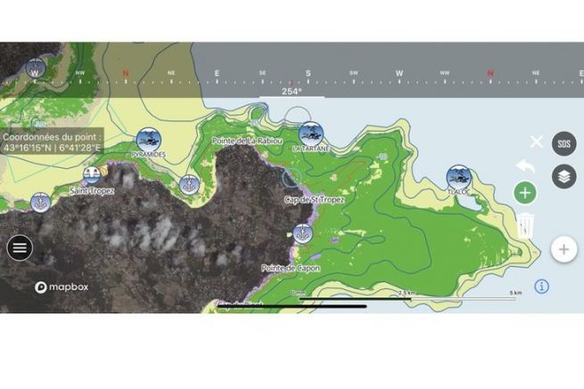
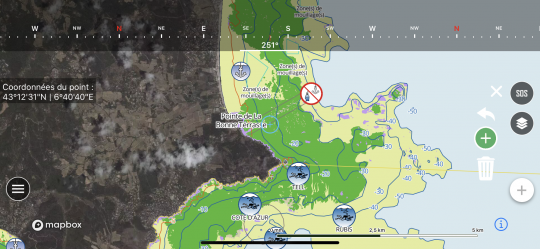
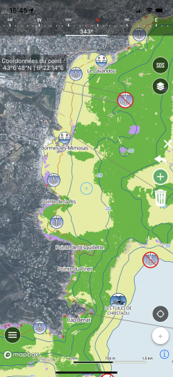
Alerted by the obvious degradation of Posidonia, Andromeda Oceanology decided to make their maps of the seabed available free of charge. Through the Donia application (available for Android and iOS), the yachtsman has access to a very precise cartography of all the coasts coloured according to the nature of the seabed: Green = seagrass, brown = dead seagrass, purple = rock, young = sand.
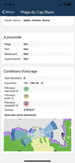
An aid for wetting
This application is not there to prohibit anchoring, but on the contrary to help anchor better. By guiding you towards sandy areas, with a precision of the data to the nearest metre, you can choose to set your anchor on a virgin bottom of posidonia. In addition to preserving the grass beds, you will also have a safer anchorage, as an anchor slides over the grass when it holds much better on the sand.
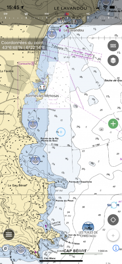
Premium options
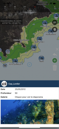
In its Premium version, you can benefit from the SHOM cartography, transforming Donia into a real navigation application. You can mark your anchorage point and manage anchorage alarms. Very complete, Donia also gives information (photos) on the bottom and indications on regulations. Close to the divers (Adromède Oceanologie dives up to 8 months /12 to draw up its maps), the dive sites are also listed. The community aspect is not forgotten with the possibility to share its anchorages, dives or fishing. You can also find information on the ports with all the important data.
A very accessible Premium version
In its free version, Donia gives access to all the bottom maps and will be enough to find a clean anchorage without any trace on the ecosystem. To navigate, it is advisable to use the Premium version either with the annual subscription (24.99 euros/year) or with a monthly subscription (2.99 euros/month). A straw when it comes to making ends meet on your holiday budget..
Find in video below: the evil that an anchor can create on the posidonies

 /
/ 