The call of atypical destinations resonates in the world of yachting. Access to the islands we present is generally restricted due to their ecological fragility and the importance of preserving them. Extreme weather conditions and their isolation reserve them for a limited number of experienced sailors, without preventing others from dreaming of them. As nature reserves, they offer a haven where sub-Antarctic flora and fauna can thrive undisturbed by human presence.
Visiting certain islands is subject to strict regulations, resulting in access limitations or regulations. Special permits, generally issued to scientists, researchers and nature conservationists as part of research or conservation programs, may be required.
We strongly recommend that you contact the relevant authorities and plan your trip in accordance with current regulations.
Campbell Island, New Zealand
Anchorages and conditions
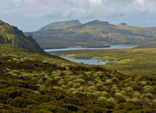
Located at latitude 52° 32' 03'' South and longitude 169° 09' 59'' East, Campbell Island, a New Zealand Australian territory of volcanic origin, covers 112.68 km2. A cautious approach is required due to the presence of rock formations surrounding the island, such as Dent Island, Folly Island, Jeanette-Marie Island and Jacquemart Island.
With its mountainous terrain dominated by Mount Honey, reaching 569 metres to the south, and its extensive fjord, Perseverance Harbour, Campbell Island offers natural shelter, but vigilance is required.
The Southern Ocean belt, subject to powerful winds and violent cold fronts, imposes average winds of 15 to 20 knots, with gusts often exceeding 50 knots for around a hundred days a year. Every year, Vendée Globe sailors sail close to the island. During the first edition in 1989, sailor Mike Plant was assisted by a scientific team from the island. He didn't finish the race and finished 7th in the "unofficial" rankings.
Points of interest
A UNESCO World Heritage Site, the island remains uninhabited. Its climate, imbued with humidity, cold and wind, shapes its unspoilt landscapes, making it a haven for sailors in search of tranquillity.
The island is an important nesting site for several species of seabird, including king albatrosses, giant petrels, shearwaters and cormorants. Fur seals are also present in colonies. They use the island's beaches to breed.
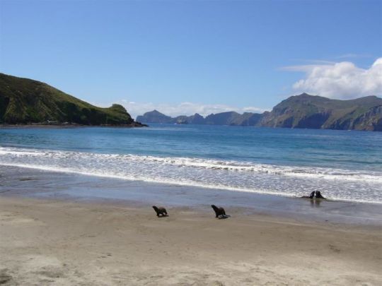
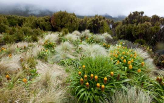
The vegetation consists mainly of meadows, bogs, shrubs and megaherbs.
Tree growth is limited, with only one introduced specimen of Picea sitchensis growing on the island, listed in the Guinness Book of Records as the most isolated tree. Measuring around 10 meters, it is over 70 years old.
South Georgia Island, South Georgia
Anchorages and conditions
South Georgia Island, located at 54° 15' South and 36° 45' West, is a British overseas territory with a surface area of 3,755 km2 bordered by the Scotia Sea and the South Atlantic Ocean. The port of Grytviken is a great base for immersing yourself in the island's whaling history.
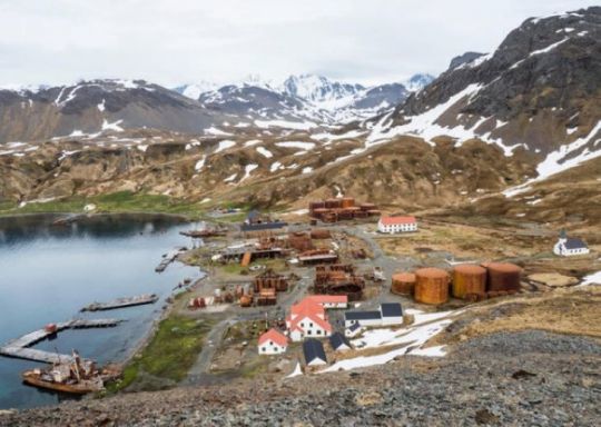
South Georgia's coastline is dotted with isolated bays offering more or less sheltered anchorages.
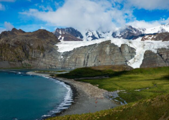
Circumnavigation of the island requires special attention due to the powerful westerly winds, the howling fifties, which persist throughout the year, interspersed with brief lulls. Virtually all precipitation comes in the form of snow. These harsh climatic conditions make approaching the island by sea a tricky business, not least because of the formation of katabatic winds.
Points of interest
South Georgia is a very mountainous island, with eleven peaks rising above 2,000 meters in two ranges: Allardyce and Salvesen.
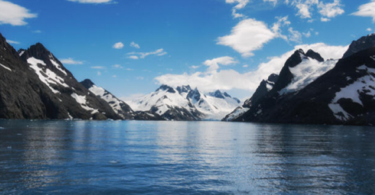
The snow petrel can be observed nesting in mountains above 1,000 meters. Other birds, such as the howler albatross, prefer coastal plains, choosing nesting sites at lower altitudes.
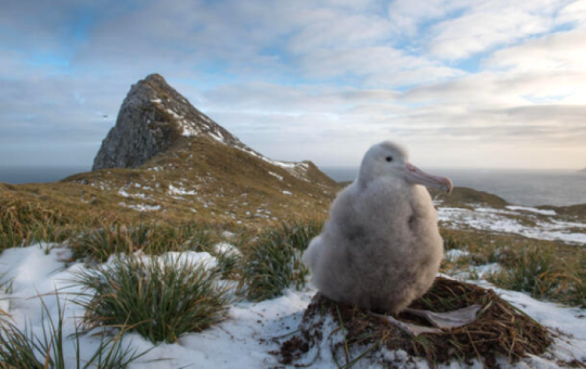
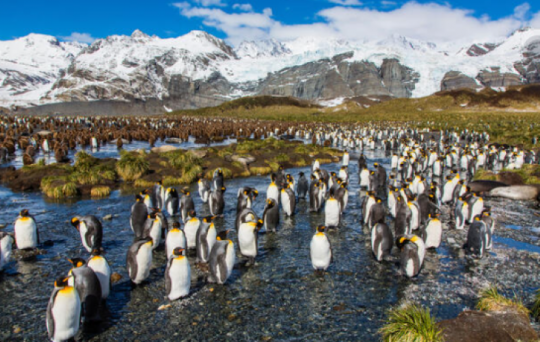
Reindeer were originally introduced to the island by man, so that Norwegian whalers could easily find food around their base. Fortuna Bay is renowned for its magnificent colonies of king penguins, as well as its large numbers of elephant seals. Cetologists estimate that between 2 and 4 million Kerguelen sea lions gather in South Georgia during the austral summer, making it the world's densest colony of marine mammals.
British Captain James Cook explored the island in 1775 aboard the HMS Resolution, demonstrating its insularity and giving it its current name.
Macquarie Island, Tasmania
Anchorages and conditions
Macquarie Island lies in the south-western Pacific Ocean, south-southeast of Tasmania, at latitude 54° 37' 48'' South and longitude 158° 51' 36'' East. Its highest point is around 100 m above sea level, and it is connected to the main body of the island by a low, narrow isthmus that is occasionally swept by waves during heavy storms. Approaching the island requires constant vigilance due to the powerful winds present in the geographical area. Arrival by sea from Tasmania requires a special permit from the Tasmanian Parks. On site, the few bays offer sailors relative shelter in this remote corner of the planet.
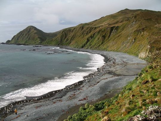
During the 2020-2021 edition of the Vendée Globe, Frenchman Louis Burton, aboard Bureau Vallée, stopped off to leeward of the island to climb the mast to repair damage caused by the failure of an autopilot.
Points of interest
Since 1948, the Australian Antarctic Division (AAD) has maintained a permanent base, the Macquarie Island Station, on the isthmus at the foot of Wireless Hill, responsible for meteorological surveys and relays with Antarctic bases, as well as scientific research.
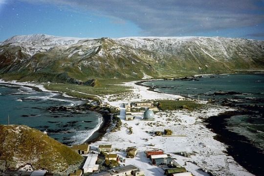
Now a Tasmanian State Reserve and UNESCO World Heritage Site, Macquarie Island is an unspoilt sanctuary where sailors can witness the delicate balance between man and nature.
Macquarie is the only place on the planet where rocks from the earth's mantle are actively exposed above sea level. Pillow-like basalt patterns can be observed, much to the delight of geologists. As the local topography is the result of transforming tectonic plates, the region is prone to powerful earthquakes.
The main marine mammal species present on the island include sub-Antarctic fur seals, New Zealand fur seals, Kerguelen sea lions and elephant seals. Troops of killer whales can also be seen hunting in the surrounding waters.
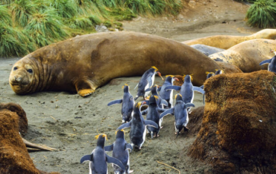
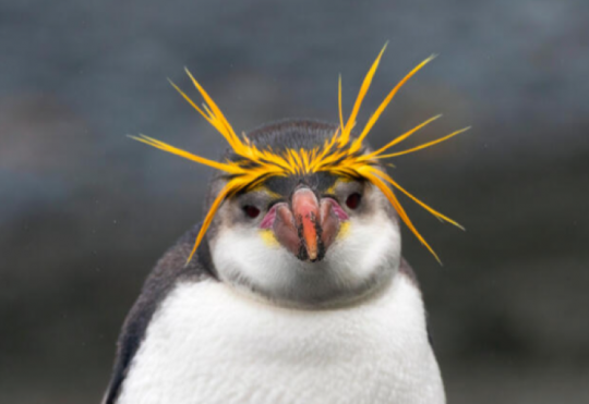
Insects, most of which are endemic, have often lost their wings due to the island's harsh wind conditions. As far as birdlife is concerned, the island is home to the predominant breeding species, including penguins, king penguins, giant petrels, skuas, albatrosses and Schlegel's gorfous, for which the island is the only known nesting site.
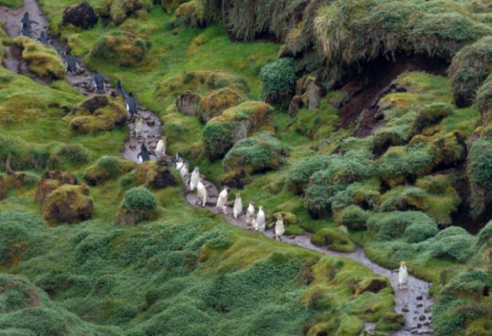
There are several hiking trails around Macquarie Island. To limit environmental damage, walking trails have been set up everywhere.
Heard Island, Australian territory
Anchorages and conditions
Located in the southern Indian Ocean at latitude 53° 06' South and longitude 73° 31' East, Heard Island is part of Australia.
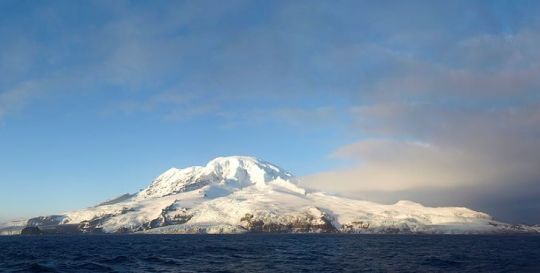
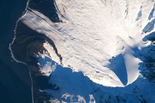
With a surface area of 368 km2, Heard Island is made up of two areas joined by an isthmus: the majority of the island is made up of the Big Ben volcanic massif, culminating at 2,745 meters above sea level at Mawson Peak, and to the northwest, the Laurens Peninsula, culminating at 715 meters above sea level at Anza Peak. Glaciers covering the volcanic massif make up 80% of the island.
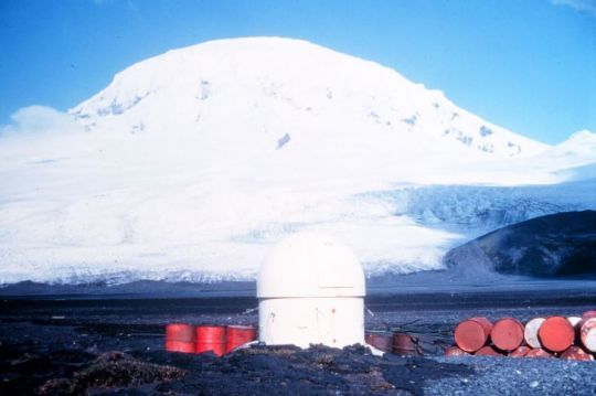
The island is only accessible from the isthmus at Anse Atlas when the sea is not too rough.
There is no port on the island, and access is strictly regulated. This island, forsaken by traditional maritime routes, is best appreciated from afar. It is a compulsory starboard marker for Vendée Globe sailors.
Points of interest
Between 1855 and 1880, the island was used as a base for seal hunting. 200 hunters alone produced 100,000 barrels of seal oil, leading to the near extinction of the species. Today, only a handful of scientists are allowed to set foot on the island, which is a UNESCO World Heritage Site.
South Shetland Islands
Anchorages and conditions
Located at latitude 62° 19' 45'' South and longitude 59° 17' 55'' West, the South Shetland Islands mark the threshold to Antarctica. They comprise 11 large islands and numerous islets, with a total surface area of 3,687 km2.
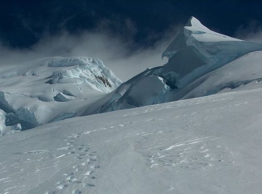
Between 80% and 90% of the surface remains permanently covered in ice. The highest peak is Mount Foster on Smith Island, at 2,105 meters, followed by Mount Irving on Clarence Island, at 1,950 meters. Deception Island is home to an active volcano; its distinctive horseshoe shape results from the intrusion of the sea into a caldera. The archipelago is cut off from the outside world by pack ice from early April to early December. Strong westerly winds blow all year round.
Accessible by boat expeditions from the tip of South America, these lands offer a foretaste of the majesty of the ice continent.
Points of interest
Several nations claim a portion of the South Shetland Islands, including Argentina, Chile and the United Kingdom. However, under the Antarctic Treaty, these claims are frozen, and no effective sovereignty is exercised. The South Shetland Islands are therefore managed collaboratively by the signatory countries to the treaty, with a particular emphasis on scientific research and the protection of the Antarctic ecosystem. A large number of scientific stations have set up there because of the relatively mild climatic conditions.
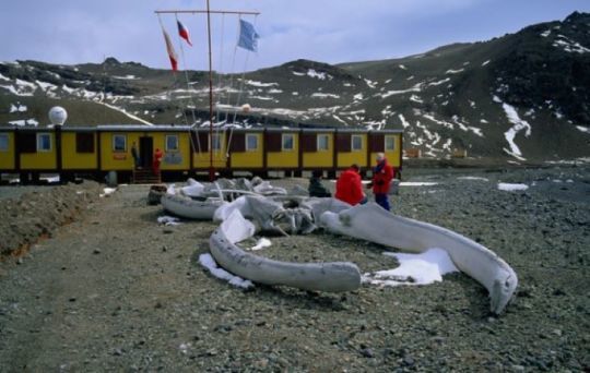
These islands, designated as specially protected areas from tourism, offer exceptional sites to explore.
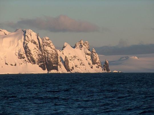
Half Moon Island boasts a colony of chinstrap penguins, while Yankee Harbour on Greenwich Island is home to a large colony of Papuan penguins. Hannah Point, on Livingston Island, is home to an impressive variety of wildlife, including elephant seals, different species of penguin and giant petrels.
Penguin Island offers a short climb to its volcanic cone, providing spectacular views of the surrounding area and the chance to spot Adélie and chinstrap penguins.
Docking on Deception Island is possible in good weather.
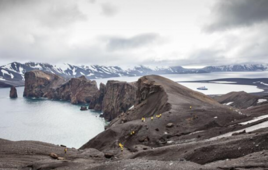
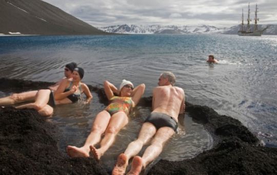
Whaler's Bay cove, well sheltered but difficult to access, preserves the remains of a whaling station and two former bases, British and Chilean, destroyed in 1969 during a volcanic eruption. At Baily Head on Deception Island, a vast colony of chinstrap penguins can be seen, and at Pendulum Cove, it's sometimes possible to bathe in the local thermal waters.
