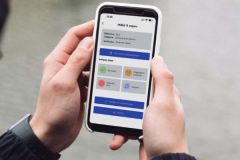
Weather 4D becomes a real navigation application! Developed by Olivier Bouyssou, this software originally designed to display weather files (GRIB) has evolved a lot. Working on tablet or smartphone (iOS or Androïd), it offers 3 levels of functionalities.
Weather
The weather part is voluntarily very graphic with colored animations showing the evolution of wind and clouds. The information is based on GRIB files with, since their free availability, the so-called fine mesh files of the Arpège Europe (0.1°) and Arome (0.025°) models. With such a precise definition, this application becomes interesting even for coastal navigation.
Routing
Historically, the application then offered a layer allowing routing. Thus, the software is able to calculate the best route to follow, taking into account the evolution of the weather, based on the boat's speed polars. But until now, due to the lack of onboard charts, this route had to be exported to another application to be able to use it in navigation.

Navigation functions to a waypoint (heading, distance...).
Navigation
But this has just changed. From now on, Weather 4D is a real navigation software with goto or route tracing functions. To do this, it uses charts from the supplier GeoGarage which are nothing less than the charts of various world organizations including the SHOM in Raster format. The only constraint to their use is to download them in your device (smartphone or tablet) when you are within range of the network. Once at sea, they are in memory and remain usable.
Of course access to updated charts has a cost. The application offers different publishers, including the SHOM for an annual subscription (59.99 euros / year for all SHOM charts). For this price, you can download charts in memory in your device (up to 2 GB) for use without connection.

Connection parameter to the shipboard NMEA network.
With the ability to connect to the NMEA network on board (provided that a Wifi gateway is installed), the application displays all the instruments on board (wind vane, depth sounder, speedoâeuros¦). In addition it is able to calculate headings and distances to a waypoint, but also to take control of the autopilot.
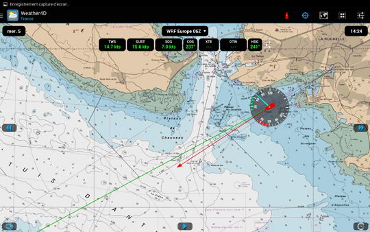
Navigation functions with integration of the sailboat parameters (real and apparent wind).
While the Weather 4D app is available for both iOS and Android app systems, this navigation software feature is currently only available on Androïd. A similar development for Apple devices is expected to be released for the upcoming boat show in Decemberâeuros¦


