A river developed since the 16th century
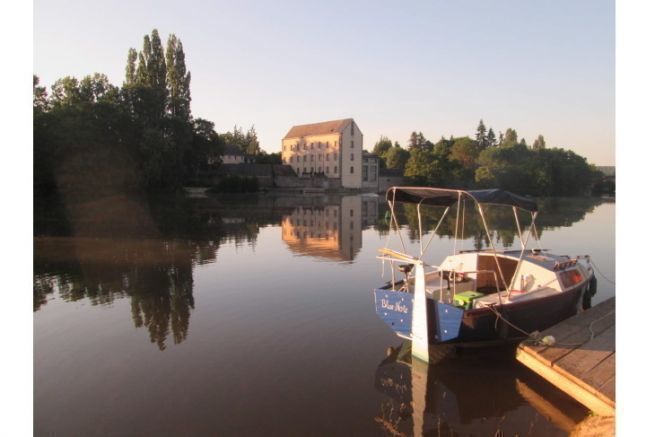
The Mayenne river has its source west of Alençon, in the commune of Lalacelle. It mixes with the Sarthe to form the Maine north of Angers, at La Pointe, and then flows into the Loire, after having fed the lake of Bouchemaine.
The development and construction of the equipment of the different reaches took place at different periods, from the 16th century to the beginning of the 20th century. The Mayenne is a wide-gauge river, and in the 19th century barges of up to 130 tons sailed on it. It was used, then, to transport wood, anthracite and roofing slate.
At the end of the 18th century, a project was born to connect the Vilaine to the Mayenne by a junction canal, but this project did not succeed. Only a small section of 2.4 kilometers was decommissioned in 1957, upstream from Mayenne to the Brives mill.
In the end, over a geographical length of 202 kilometers, the Mayenne is navigable on 122 kilometers .
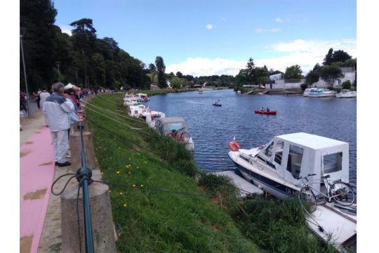
Today, the Mayenne is used to produce between 2 and 3% of the total needs of electricity of the departments crossed ( approximately 3,500 households ). It is above all a river of tourism open to all practices, sailing, motorboat, electric boat, kayak or paddle.
Christian Laigle, founder and president of the association Canotika accompanies us to discover this river. Canotika is the manager of the Chateau Gontier marina, delegated by the community of communes of the Chateau-Gontier area.
" The navigation on the Mayenne is merged in the basin of the western rivers, grouping the Mayenne, the Sarthe, the Maine and the Oudon "explains Christial Laigle, president of Canotika.

In total, there are more than 240 kilometers of waterways that are open in the region.
Original tourist stops
For Christian, there are two Mayenne rivers: " The North of the river is wilder and more landscaped than the South. It reminds the rivers of Anjou, wider and offering flatter landscapes. It is absolutely necessary to do the whole river. There are very beautiful places everywhere. It is necessary to scrutinize the surroundings permanently, because there are enormously of secret places ."
The navigation takes you through the main cities of Mayenne, Laval and Chateau-Gontier, each with an interesting built heritage. Laval has two castles and a well-preserved medieval quarter, while Chateau-Gontier will seduce with its Ursuline Convent.
Some lock houses are entrusted by the department to entrepreneurs who engage in a tourist activity. In exchange for a place to work and often to live where they can develop their activity, these entrepreneurs become lock keepers. This is an intelligent solution by the public authorities to remedy both the lack of manpower in the locks and the rural desertification around the river.
The lock houses hold surprises: " One of the houses offers accordion restoration. At the Neuville lock, it is possible to stop in the cutlery and make your own knife. Or, at the lock of Benate, the lock keeper is a restorer. During his lunch break, he is at the stove, which he leaves if a boat comes to the lock ."
In Entrammes, you can visit the Abbey of Port-Salut, where the eponymous cheese was made in the past. " The abbey only produces for its own needs" explains Christian. "You can taste and buy at the organic cheese factory adjacent to the Abbey. "The rest stop, located about ten kilometers from downtown Laval, is an excellent starting point to visit it by bike.
A digestive walk after the cheese tasting will also lead to the thermal baths of Entrammes.
At the lock of Montflours Rochefort, it is a natural proposal. "A have a walk after the sassement and discover the 300 meters of wild arm of the Mayenne with a kayak or a paddle, to understand the ancient developments of the river "Christian recommends.
Practical navigation
" On the entire route, all the infrastructures at the service of boaters are in place, available and free of charge "He continues to regret that the Mayenne, as a river, "is not the only one to be affected valley bottom "This is because it is often quite far from the villages, especially in its most remote parts.
For boats with combustion engines, there is only one refueling point on the river. It is the station of the Carrefour Market store in Château Gontier, located 300 meters from the river stop.
The development of the banks of the river has been thought according to the new ways of navigation. "As more and more boaters are roaming with boats on trailers, a free slipway is available, with free parking as well, every 10 to 15 kilometers and, in any case, at each lock "says the manager, who is also a boater and kayaker.
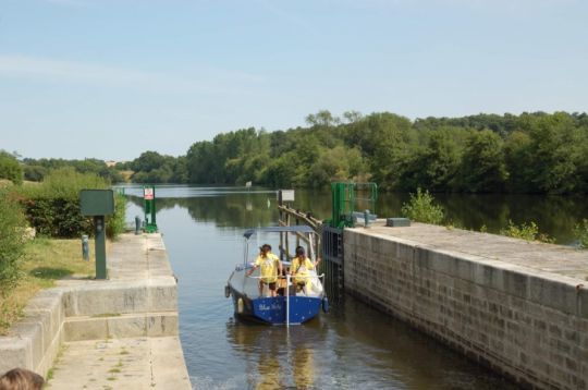
These locks are operated in the season of 9 am to 8 pm by departmental staff. Outside these hours and in the low season, it is possible to lock yourself. Each lock indicates whether or not a lock keeper is present and, if so, the operating instructions for the structure. " From the north of Chateau Gontier to Angers, the locks are electrically operated, making them easier to operate for both boaters and lock keepers ". After Laval, the staff is itinerant, moving from lock to lock ( per block of 3 or 4 books ).
Don't miss the opportunity to talk to the lockkeepers, who are always happy to answer any questions you may have, whether they are about tourism, gastronomy or anything else. " They are responsible for the maintenance of the towpath in the area. It is therefore necessary to inform them of any damage seen by boaters, so that they can be quickly repaired. "
Maintenance work on the river is carried out according to a three-year plan. The course of the Mayenne is artificially lowered for the benefit of the Sarthe, where the boats of the tributary are moved for the duration of the maintenance, two months in the autumn. The following year, the opposite movement takes place, to the benefit of the Sarthe.
To find your way around the river, a map of the greenways and rivers has been published by Mayenne Tourisme. It lists all the coordinates of the locks with the related services along the river. This map covers the river from Angers to the northern limit of the department.
" The banks are all accessible and you can moor without difficulty " continues the guide that alerts " Attention, it is prohibited to dock with trees but staking is permitted on both sides of the river. "About the side, it is recommended to use the counter-hull, both for the tranquility of the walkers ( bikes and pedestrians ) " and for your own peace of mind "adds Christian.
In summer the Mayenne is very popular with carp anglers. The recommendation, in addition to sailing at a reduced speed (c five kilometers per hour maximum ) is to look away and get as far away as possible for everyone's safety.
Some navigation tips to know, which Christian details: " Everywhere on the river, it is necessary to stay at about 10 meters from the shore, in normal navigation, to avoid possible underwater obstacles. "
Navigation channels, partially marked, are in place on the river: " Above Laval, the channel is on the left, marked in difficult or dangerous places. Below Laval, the channel is still marked in some places, but goes to the right, in the conventional direction. "
Be careful in case of storms or heavy rains, water levels can rise rapidly, with particularly fast currents: " It is not uncommon " explains the boater " that you go from 2 to 3 kilometers per hour of current to more than 15 in the space of a few minutes, because the Mayenne is a river that receives rainfall. In case of a strong storm, I recommend to get to the safety of a pontoon or a quay and to wait for the current to stabilize. "
Local tips and tricks
Christian's first comment concerns travel: " The Mayenne is quite steep. It is therefore important to think about bringing a means of transportation for trips on land. The bicycle is ideal, because the distances are not too long. Ideally with electric assistance, it is even easier. "
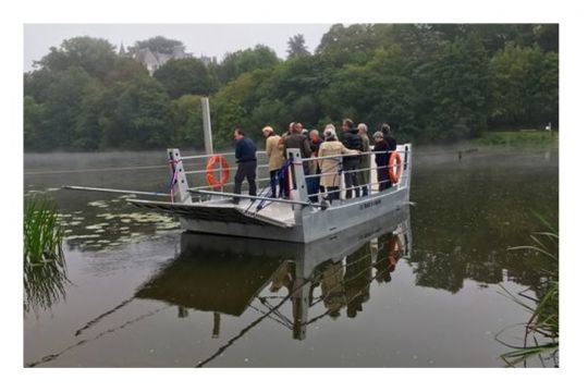
As a family, you must absolutely cross the river by taking the Ménil ferry. It allows cars, pedestrians, horses, motorcycles, in short, everyone, to cross the river, free of charge.
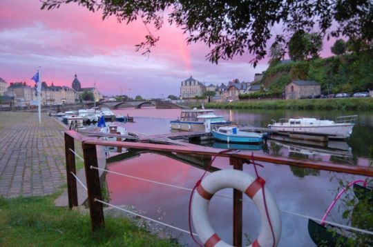
In Chateau-Gontier, the marina is both a place to rent boats ( including the very original pedal boats that you must try ), tourist information and services. " The rental of a 100% French electric boat, designed and created in Nantes is even possible in the port "explains Christian.
" You can use the black water pump on the private pontoon of the Chateau-Gontier stopover. You just have to inform the owner of the boat so that he can free the mooring place. "
Waiting for the euro pumping site to become available free of charge - it is possible to dock along the stone quay to go shopping nearby.
Moreover, Christian's agapes lead him to several addresses that he recommends: " Thomas and his top hat are not to be missed. He is a lock keeper and cook in Origné. He brings a touch of humor and good humor to a traditional cuisine that can be ordered from his boat and collected at the lock. At the Entrammes stopover , do not miss the restaurant of the boatmen, held by the person in charge of the halt. In Azé this time, the priory allows you to eat while keeping an eye on your boat. "
At the lock of Montflours Rochefort, " you should not miss the guinguette above the town of Laval. Continuing on, you will come across the lock keeper's house which offers groceries and local products, before the river stop of Montgiroux. "Christian recommends.
The Canotika Association has set up a Whatsapp group that allows boaters on the river to communicate with each other. " It is even used if someone is down to give him a hand " says the guide " The whole voluntarily . Jean Paul, one of our members, can help out any boat just by getting paid for his fuel. "
To join this group, just contact Christian, via the website of his association.
The Mayenne in brief
- Length 122 kilometers
- Locks: yes, 45
- Speed limit: 8 kilometers per hour
- Border crossing : No
- Vignette / navigation tax : No
- Managing institution: Departments (Orne, Mayenne, Maine-et-Loire)
- Renters : Les Canalous - Capitaine Rivière - Alpha Croisière
- Departments : Orne, Mayenne, Maine-et-Loire
- Minimum air draft: 2.70 meters (Europe Bridge in Laval) 3.50 meters everywhere else
- Minimum draught : 0.80 meters
- Period of unemployment: None
- Smartphone application ? Yes (Mayenne River on Google Play )
