The boaters of Marseille and the surrounding area are not happy. If, for the moment, the ban on anchoring in the creeks of En-Vau and Port-Pin is limited to boats over 24 meters in length, this ban will be extended to all boats by the summer of 2021. For the time being, navigation is still allowed.
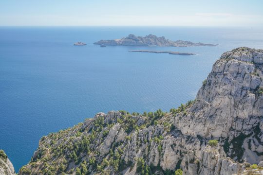
Started in 2018, the preparatory work for this revolution of anchorages in ecologically vulnerable areas has brought together more than 200 partners (state, environmental preservation associations, associations of boaters or fishermen). The associations that today are crying scandal or deprivation of freedom knew that things were being prepared and had the time necessary to prepare and to change their practices towards areas less subject to pressure, especially in summer. It was on December 10, 2020 that the implementation of the overall scheme for the organization of anchorages was unanimously adopted by the Board of Directors of the National Park and validated by the State authorities and the local authorities concerned, including the communes.
These bans are the logical and coherent continuation of the work done by the local authorities to preserve the environment of the Calanques. As shown, for example, by the sanctions given to two boatmen who were illegally transporting passengers in the Calanques last May.
Restrictions put in place as and when required
In concrete terms, the proposed changes start today and will be spread over several weeks. The information component is starting, really upstream of the repressive component. Indeed, the National Park provides paper documentation as well as an application and encourages all the traditional actors (SHOM, National Navy...) to quickly update all the documentation for boaters. Then, throughout the summer, information patrols for users will circulate from cove to cove.
Finally, when it is impossible to move an anchorage area that is currently permitted, further away from the area to be protected, the National Park will set up anchorage solutions on buoys, in particular, thus avoiding scraping the bottom. This will be the case, in particular, in the West Pomègues (Frioul), in Marseilleveyre, Sormiou, Morgiou - Pierres Tombées, Ile Verte, La Ciotat bay or at Pointe Grenier (Saint-Cyr-sur-mer).
Rules according to the size of the boats
For the time being, the following organization is in place.
- For boats of more than 24 meters, anchoring will be moved offshore, with the creation of a zone forbidden to anchor in shallow waters (less than 30 m deep).
- For boats over 45 meters, creation of mandatory anchorage areas, off Cassis, La Ciotat and Saint Cyr-sur-mer.
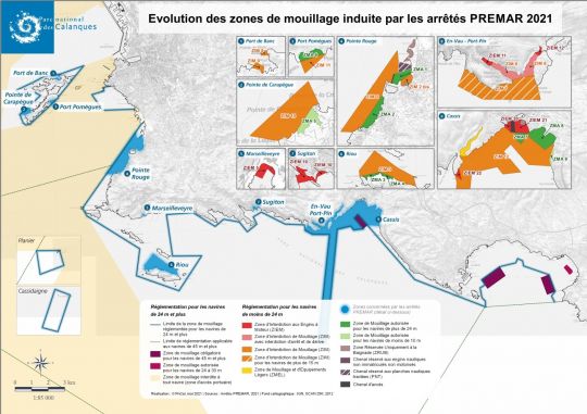
For all boats, finally, concentration of anchoring on sandy areas with the creation of authorized and prohibited anchorage areas on five sites in Marseille and three sites in Cassis.
- In Marseille:
- North and South of the cove of Port de Banc - Frioul
- South-West of the island of Pomègues - Frioul
- Calanque of Port Pomègues - Frioul
- North and South of the Pointe Rouge
- North coast of Riou Island
- In Cassis :
- Off the Grande Mer
- Anses de l'Arène and Corton
- Soubeyranes cliffs
Then, on both sites, a decrease in navigation and anchoring for the benefit of beach activities on two sites is set up:
- Calanque of Marseilleveyre
- Calanque of Sugiton
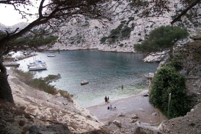
Finally, a vigorous measure of preservation of the two emblematic and saturated creeks of En Vau and Port Pin with a permanent ban on anchoring, stopping (on a buoy or by dynamic positioning) and drifting of any vessel.
The measures relating to vessels over 24 m are applicable as soon as the prefectoral decree is published.
The measures relating to vessels of less than 24 m will be applicable as soon as the corresponding markings are put in place on the water in the next few weeks.
Modulation according to the season requested by the boaters
It is, moreover, this seasonality that makes some boaters react, some of whom are demonstrating this Sunday to show their opposition to these orders: "Why ban year-round?" according to Xavier Esnault, one of them. "We want to continue to protect, but it was enough to regulate by refusing access in the summer, during the periods of great affluence. For me, usually, at 6 p.m., it's an aperitif at En-Vau on my sailboat, and I can tell you that there is no overcrowding at all. We find ourselves deprived of our freedoms, our heritage and our traditions. It may seem a bit chauvinistic and selfish, but it's our home! We live in Cassis and we can no longer go to our creeks!"
Preservation of the environment put forward by the natural park
Didier Réault, President of the Calanques National Park explains "The En-Vau cove is too narrow to put buoys and be able to circulate. We made the choice to preserve the environment, to ensure that as many people as possible can enjoy it."
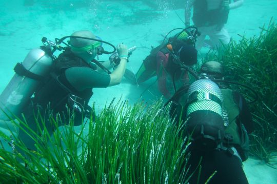
The objective of this measure is to protect the Posidonia meadows that populate the Phocaean seabed. A marine plant organized in underwater meadows, it constitutes the key natural habitat of the Mediterranean. It covers only 2% of the surface of the Mediterranean, but shelters 25% of the animal and plant species.
Posidonia performs multiple environmental services:
- Major nursery and reproduction area for Mediterranean marine species.
- Production of fishery resources: 30 to 40% of the fish species consumed are caught there.
- Stabilization of the littoral: the herbarium makes it possible to stem the erosion of the coasts (damping of the swell and protection with the dead leaves which form banks on the beaches).
- Sustainable carbon retention: the Posidonia meadow sequesters 1500 T of CO2 per hectare, i.e. 7 times more carbon than a hardwood forest and 3 to 5 times more than a tropical forest. Oxygen production: 1 m2 of meadow produces 14 liters of oxygen per day.
These measures have been taken in recognition of the fact that the surface area of Posidonia meadows has decreased by nearly 20% during the 20th century alone. The main pressure exerted on the Posidonia meadows today is the anchoring (the mechanical impact of anchors) of ships.
In the bay of La Ciotat, 30 ha of sea grass beds have been lost in 10 years: the equivalent of 240 Olympic swimming pools!
How to anchor, today, in the Mediterranean?
These are common sense tips that any reasonable boater has in mind that the National Park reminds. But they are worth repeating.
- I learn about the regulations for anchoring in the Calanques and I respect them.
- I prefer to choose a sandy area that can be seen from the surface by its light color. I can also use the " Donia ".
- I wet a length of chain of 3 times the water height.
- I avoid setting my anchor by beating back.
- I pull up the anchor to the plumb of the boat with a bow.
