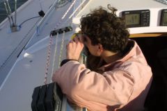
Old-fashioned navigation, certainly, but still practical. A bearing compass is a navigational compass with an alidade superimposed on it, which makes it possible to measure the direction of a bitter or remarkable object or construction horizontally, relative to north.

Indeed, as soon as one moves away from the coast, most of the bitterness fades away and only remarkable bitterness and points scattered on the horizon remain.
In the absence of alignment, we therefore proceed by bearings. It's time to remember a little geometry, you know the thing with angles?
But we can put some colour in it!

Or forms

So let's take stock!
To do this it is a question of:
- Taking over
- Correct them by the value of the declination
- Wear them on the card
- Check the consistency of the result
To take bearings or the bearing of a bitter is to measure the angle at which the bitter is seen in relation to the North.
Correct the rise in the declination value. (Not to be confused with the deviation!)
The compass acts according to Magnetic North and this does not coincide with Geographic or True North (that of the meridians). The angle between these "two Norths" is called declination. This angle varies depending on where you are on the globe, but also over time, because Magnetic North is not fixed. It comes and goes over the centuries..
Depending on the location, the declination is West or East. The information is specified in the compass rose on the map. For an East declination, it must be added to the bearing value, if it is West it must be subtracted. Easy, isn't it ?
A trick to remember, to ask the question: Is it more or is it less?
What can be written IS more, WEST less..
Plot the bearing on the map.
To put a true bearing on the map you need a Cras ruler or a Breton protractor. We are not going to detail here the handling of the rule that you will find in previous articles . Nevertheless, the point can be made with two or three bearings. With only two bearings, it must be ensured that they are not too close together, ideally the two bearings should intersect at right angles. The point with three bearings, if possible at least 60° from each other, makes it possible to obtain a triangle, a hat, in which our proud ship is located. The bigger the hat, the worse the point! There must be a mistake somewhere. If there is no hat and the three bearings intersect perfectly, either we believe in miracles or we take a fourth bearing to confirm the whole thing.
Check the consistency of the result
Just compare the map and the landscape. On the map, starting from the point obtained, one should see the remarkable elements of the landscape from the same angle as in reality.
Another concept to be known to avoid mistakes, the principle of the compass rose:
- North is at 0° or 360°
- East at 90°
- South at 180°
- West is 270°.
In addition, there are subdivisions that are good to know such as NE at 45°, SE at 135° etc.
The knowledge and representation of the rose allows to validate bearings as well as to orient the ruler on the map.


