The history of cartography
Man has always sought to map his environment in order to understand the world in which he lives and evolves. The oldest map found is a Mesopotamian map engraved on terracotta, dating from before the 5th century BC. We will also discover Babylonian and Chinese maps from the same period.
The hypothesis of a round earth is attributed to the Greek Thales of Milet in the 6th century BC. Three centuries later, Eratosthenes, director of the Alexandria Library (as well as inventor of the term "geography") was the first to calculate the circumference of the earth with a small margin of error.
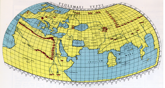
In the 2nd century AD, the Greek mathematician and astronomer, Ptolemy laid the foundations of modern cartography. It creates the first planisphere with an equator and turns the north upwards.

Representation of Ptolemy
In conclusion, well before the era of contemporary cartography, we know the shape and size of the earth. It remains to be discovered and mapped the emerged lands. It will take many centuries of navigation and discovery to accurately establish a modern map.
Influence and issues of maps
A map delivers or suggests a vision of the world to the viewer. But it is an instrument of power: economic, scientific and military policy.
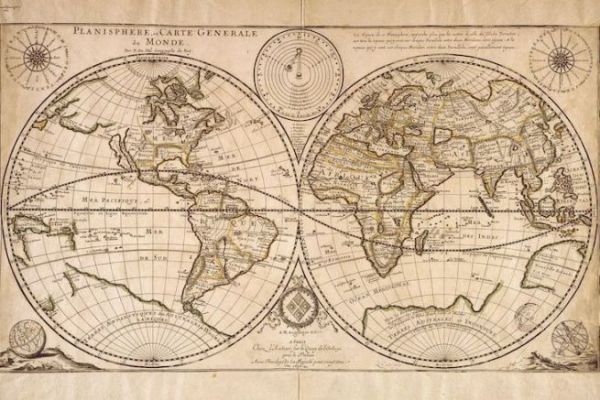
In the 13th century, in the midst of a boom in maritime trade, cartography was a state secret for the Spanish and Portuguese monarchies. Secrets that are sometimes well kept for these kingdoms thirsty for gold and spices that are constantly expanding their territory.
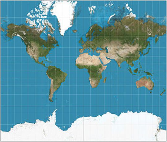
Many maps of the world followed one another on the ships, until the appearance of the Mecator projection in 1569, formalized by the Flemish geographer Gerardus Mercator. It has established itself as the standard planisphere thanks to its precision for maritime travel. This 450-year-old projection is well suited to sailors and is still relevant today.

Mercator's representation
Why are the cards fausses??
As we saw in the article about loxodromy and orthodromy any cartographic projection causes deformations. And that's normal, because we are moving from an almost spherical three-dimensional shape - the earth - to a flat two-dimensional object - the map. There is only one step to take to argue that a map is a distorted representation of the world.
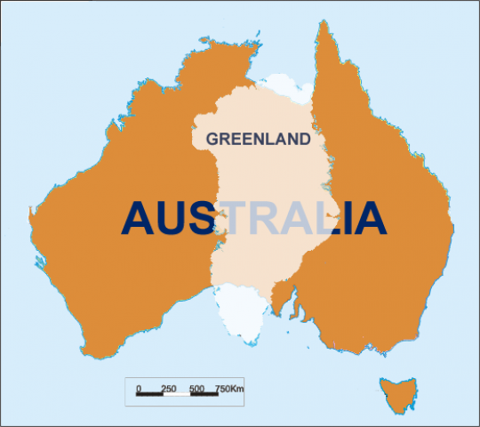
With the advent of digital technology, Mercator representation has become the reference for representing the world as a whole. However, if it is practical for seafarers, it is nonetheless imprecise for global mapping. For example, on our maps Greenland appears as large as the African continent, which is 14 times larger. It is therefore important to keep a critical distance.
There can be no perfect world map, only the spherical representation is accurate.

A representation of the real surface area of Greenland and Australia


