The Ushant rail, a pollution prevention system born of an ecological tragedy.
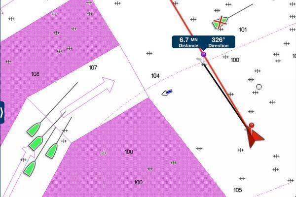
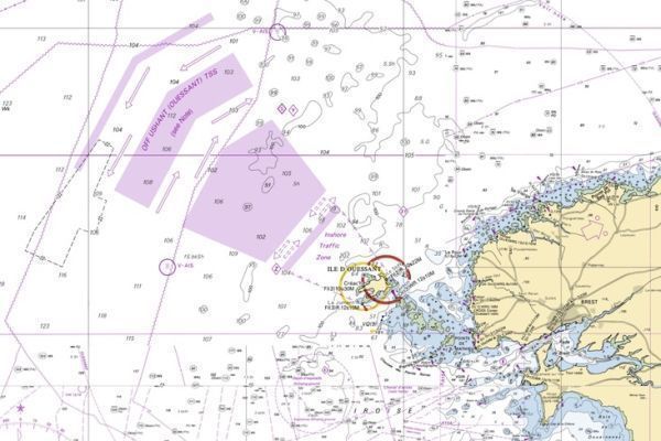
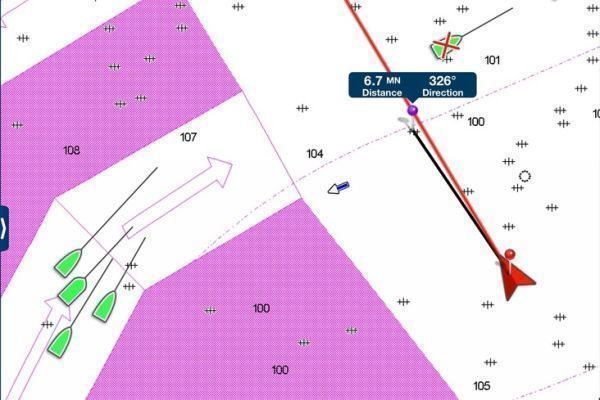
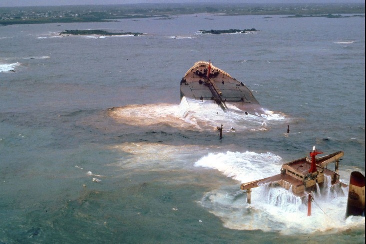
One of the worst ecological disasters in maritime history occurred on March 16, 1978, when the oil tanker Amoco-Cadiz crashed into the reefs off Portsall, Finistère. The 227,000 tonnes of oil she was carrying spilled into the sea, fouling 360 kilometers of Brittany's coastline. In response to this disaster, the authorities decided to reorganize ship traffic in the Channel, creating a "Traffic Separation Scheme" (DST), consisting of three shipping lanes, forming what is commonly known as the "Ushant rail". This DST came into force in 1980, with the aim of forcing "upbound" ships carrying hydrocarbons and hazardous substances to take a route further offshore.
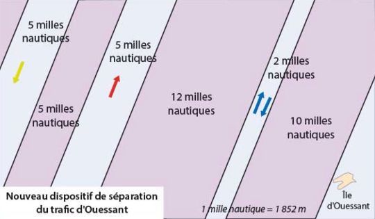
Ushant rail simplified and pushed offshore in 2003
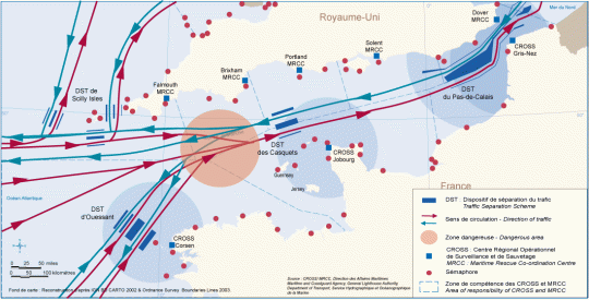
When storms break out, the sea churns with giant waves that can reach over 15 meters. Faced with this danger, it's imperative that ships keep their distance from the steep cliffs surrounding Ushant and its neighboring islands of Molène and Sein. The DST, or traffic separation scheme, is a system that organizes the traffic of ships at sea into two parallel lanes: an uphill lane for those going in one direction, and a downhill lane for those going in the other, on the same principle as two-way roads for cars, with a white line in the middle...
In 2003, the DST was again modified, following approval by the International Maritime Organization (IMO). The lane closest to Ouessant, 24 miles (43 km) from the island, is dedicated to ships entering the Channel; the lane furthest away, 43 miles from Ouessant, is for ships leaving the area. The shipping lanes, each five miles (9 km) wide, are separated by a buffer zone of the same width. Ships engaged in "cabotage" without transporting hazardous materials may, if they wish, use the 1st lane 10 miles from Ushant. Finally, passages such as Fromveur, Four, Helle and Raz de Sein are accessible to passenger ships operating on regular routes.
An area under close surveillance
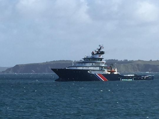
To enforce the law in this area, the French Navy has been given a policing mission. The Maritime Prefect can divert any vessel behaving in a suspicious manner. A surveillance center, CROSS Corsen Ouessant Trafic shared between the French Navy and the Maritime Affairs administration, was created and equipped with a long-range radar, first installed on a semaphore at Ouessant, then on the radar tower at Le Stiff. Although only 72 metres high, it nevertheless reaches a height of 130 metres. A deep-sea tug, the Abeille Bourbon, is assigned to the CROSS for all rail operations.
The number of emergency interventions on the Ouessant rail network has decreased over the years, thanks to reinforced monitoring and accident prevention. In 2022, Ouessant Trafic had to deal with 38 abnormal situations, 33 close calls and 433 anticipated situations, and 178 breakdowns or maintenance stops. The deep-sea tug Abeille Bourbon intervened seven times to rescue damaged vessels. Nine infractions were recorded, involving four commercial vessels, two pleasure craft and three fishing vessels. The infringements concerned failure to keep a proper lookout and/or refusal to comply with Ouessant Trafic's requests, dangerous behavior linked to non-compliance with RIPAM rule 10, two passages in the coastal navigation zone, and a collision between two vessels.

 /
/ 