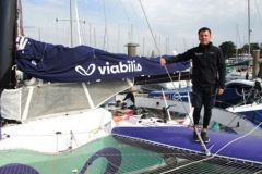
Less known than the big routing softwares on the market, qtVlm is not less interesting. We present it to you through a concrete example, during a sailing trip off Ireland.
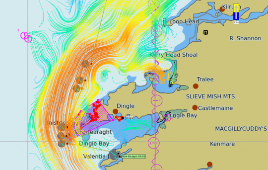
We are near Slyne Head in Ireland and we want to reach Valentia Island, a little bit further south. To evaluate the time we need to make this trip, and to take the best possible route, we will use qtVlm.
Installing and using qtVlm
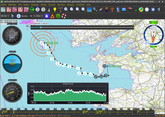
The executable is available on the official qtVlm website. A brief documentation is also available in French, highly recommended reading to tame the interface of the software and have an overview of its features. You can install it for free on your PC or Mac.
We will focus here on the routing function, which, along with the simulation tools, is the specialty of qtVlm. However, qtVlm is a real navigation software, just like OpenCPN and MaxSea.
Select and install maps
qtVlm is compatible with many types of cards, whether S57/63, CM93, Mbtiles, Gshhs or kapsâeuros¦ They can be imported in the menu QtVlm ? Configuration ? Maps . Free online charts can be used without installation, but they do not have sensors and require an Internet connection, and are therefore not very suitable for the boater.
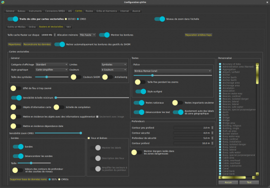
In the toolbar, the first five buttons are used to activate or deactivate different types of maps previously configured in the menu discussed earlier.
Configure your boat
Configuring your boat well is crucial for the accuracy of the routing. The configuration can be optimized as you go along. Configuring your boat is done in the menu Boat ? Boat settings. The polar is transcribed into a file that contains most of the information on the boat's performance at different points of sail and wind speeds. If you don't have this file, you can select your boat, or a similar model, from the polar library by clicking on Polar Server .
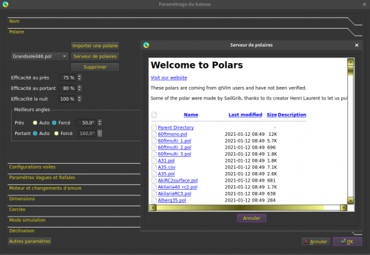
Still in the tab Fleece the efficiency and angle values are very useful to fine-tune the routing. Finally, there are many other parameters to discover in this interface to adjust the routing behavior.
Specify the point of departure and arrival
The departure can be from the boat, if GPS data is available, or from a marker on the map. The arrival is necessarily a marker, which can be added very easily on the map with a right click New brand . These points cannot be on earth.
Download the weather forecast
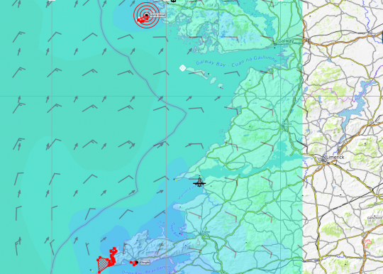
The grib type weather file can be imported from the computer, or directly downloaded by qtVlm in the grib . For this last option, you must first select the area on the map by simultaneously using the CTRL and the left mouse button, then release CTRL before the left mouse button.
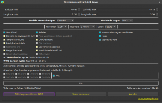
Then go to Grib ? Grib location 1 ? Grib Xygrib . In the window that appears, let's use for example the atmospheric model ICON-EU and the wave model WW3 . Then pig the wind, gusts, swell, wind waves and wave height combined.
Start routing
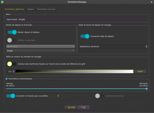
Once these preliminary steps have been completed, we can launch the routing very simply. In the menu Routings ? Create a routing specify the start and end points, then click on OK . QtVlm will compute the best route, propose to optimize it and transform it into a route.
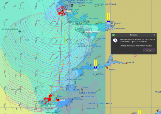
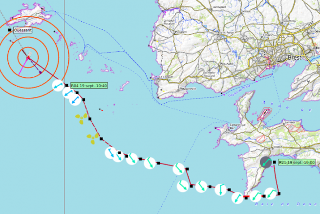
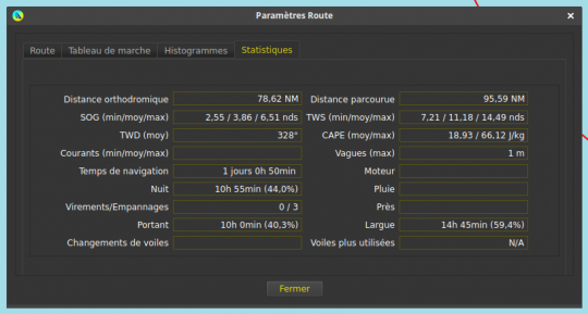
The route is visible on the map, and its detailed characteristics can be consulted with a simple right click. The stages are visible with dots, white when it is daytime and black when it is nighttime, containing an estimate of the wind speed and direction.
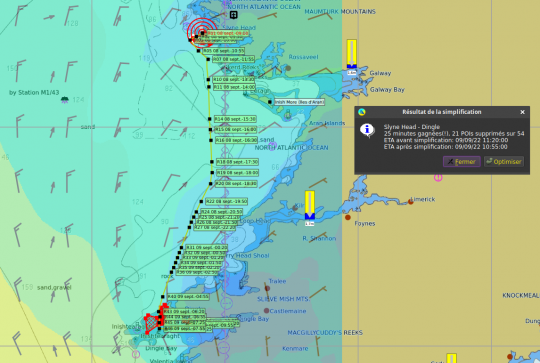
Optimize your routing
Sometimes qtVlm draws a route in areas that you do not want to cross, or that contain islands and obstacles. In this case, it is possible to define Barriers with the menu that bears that name.
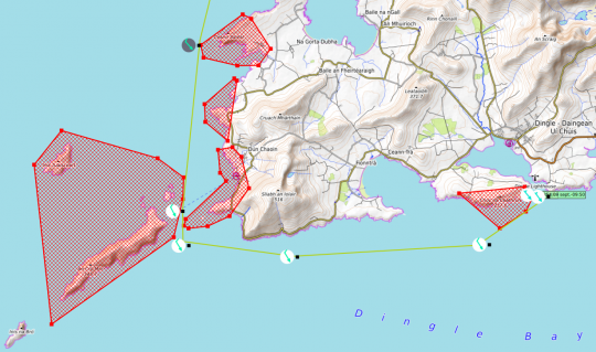
Finally, we can optimize the accuracy of future routing in two ways, by playing on the polar and efficiency parameters.
The first one consists in launching routings on a trip already made, at the right dates, with the corresponding grib file. This one must have an end date later than the calculation date. We then play with the parameters, until the route corresponds to the track and the estimated speeds are good.
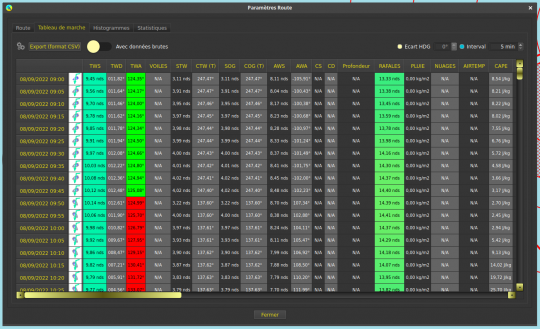
You can also run regular navigation routings, and fine-tune the values to obtain a speed and direction that correspond to reality.
qtVlm is an affordable routing solution, interesting for boaters who want to prepare their sailing without opting for the big software on the market.
