Geography of places
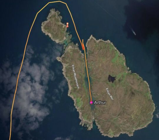
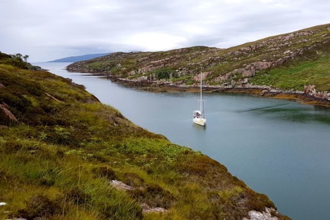
The Crowlin Islands, northwest of Kyle-Akin, are mainly composed of 3 islands: Eilean Mor to the east, Eilean Meadhonach to the west and Eilean Beag to the north. The anchorage we present to you is inaccessible from the south, except with a shallow draught during high tides. In any case, the safest way is to go through the north, and to choose a rather low tidal coefficient if you have a large draft.
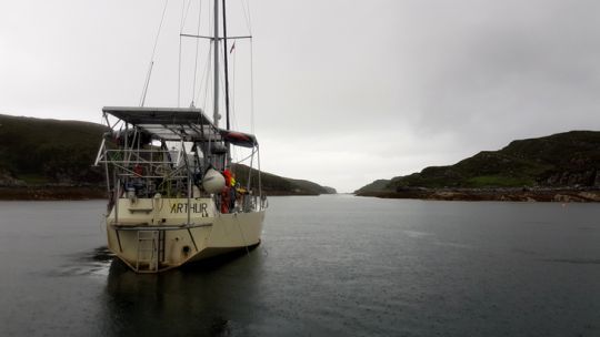
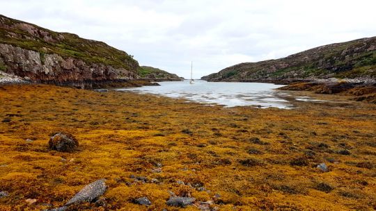
With a coefficient of 50, we measured 2.5m at low tide, which by high coefficient leaves about 1m of depth at low tide. Once the channel is crossed, the anchorage area is large enough to drop the anchor in the middle. The bottom is rather uniform, composed of mud and some seaweeds.
Crossing the fault
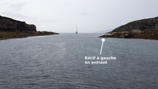
At high tide, enter the fault from the north, staying well in the middle. There is a rock to avoid on the west side when entering. A first wide and shallow area is immediately followed by the deep anchorage located in the center of the pass. The rocky overhang to the West should be avoided, although the area remains relatively deep.
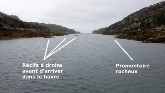
The second pass gives access to the southern anchorage. It will be necessary to tighten slightly to the West to avoid some deep reefs located to the East when entering. Then, leave a distance of about 5m with the rocky promontory, just before entering the harbor. The deepest area is located south of the center of the harbor.
Anchor in the harbor
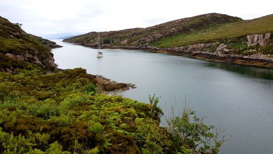
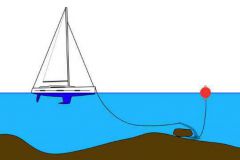
In light winds, anchoring in the center should be enough. The edges are steep enough to leave room for evasion. However, when we went there, we dropped an anchor to the south and hit two mooring lines to the coast to secure our boat. The idea was to protect ourselves from an easterly gale¦ which we did not feel.
A nice spot to walk and rest
Once there, you can hike on the islands which offer a beautiful view of the fault and the surroundings of Skye and KyleAkin. The area is devoid of marked paths and is made up of tall grass and heather, so you will need to bring hiking boots.
Finally, it is worth mentioning the presence of midges mainly in the evening, which will not come to disturb you on the boat. A very good plan to rest in a beautiful environment, far from the crowd.
