With 19,193 kilometres of coastline, France - not the hexagon - occupies 9th position in the ranking of countries by length of coastline. With the exclusive economic zone extending 200 miles offshore, it is highly likely that the competitors in the IMOCA race will come across a territory dependent on Paris during their journey.
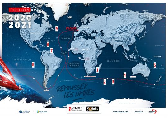
Beyond the African continent, the possibilities appear
Besides, there will be plenty of opportunities. Let's apprehend them in the order of the race route, once they have passed the Bay of Biscay. There is no French territory strictly speaking along the west coast of Africa. Certainly countries that are friends of France such as Morocco or Senegal, but no possession in the diplomatic sense of the term in these environs.
1 - Europa - 22° 22? S, 40° 22? E
The first territory dependent on Paris with which these sailors will share the same longitude (40° East) after the Cape of Good Hope will be Europa.
Europa has been a French dependency since October 31, 1897. Administered by the TAAF ( French Southern and Antarctic Lands ), Europa is part of the Scattered Islands District. It is an archipelago of 5 islets all located between 10° and 25° South latitude in the Mozambique Channel and north of Reunion Island. The total surface area of all these pieces of land does not exceed 43 square kilometres. Their interest does not therefore lie in the potential extension of the national territory. It is the whole of their waters under French jurisdiction, totalling 640,400 km2 ( approximately 6% of French maritime territory ) that is of real interest.
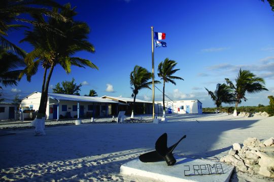
With a surface area of about 30 square kilometres, this island is located halfway between the east coast of Africa and the west coast of Madagascar. Its inhabitants are mostly birds of 13 distinct species, 2 of which are endemic. They are numerically more numerous than the 14 men of the 2nd RPIMa a gendarme who live on the island. These soldiers are relieved every 45 days by plane. A competitor's stopover there is highly unlikely, as it is very much to the north of the Vendée Globe route.
Closer to Antarctica
Heading eastwards, our sailors will get closer to Australia and touch the longitude of Crozet, gateway to the French Southern Lands and Seas. This group of islands is made up of the three groups of islands that make up Crozet, Kerguelen, Saint-Paul and Amsterdam. Crozet, the largest of the group is French possession since a certain Marc-Joseph Marion du Fresne ( nicknamed Marion Dufresne ) landed his second, Julien Crozet, on the Island of Possession on January 24, 1772. Does the name Marion Dufresne mean anything to you? Indeed, it is the name of the bunkering ship of these southern lands, the Marion Dufresne. It was aboard this ship that Kito de Pavant was secured after the collision with a UFO in 2016 .
2 - Crozet - 46° 24? S, 51° 45? E
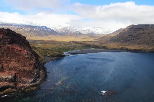
On the Crozet Islands, competitors will mainly encounter penguins, golden gorfus ( 4 million ) and royal penguins. To complete the neighbourhood, the jumping gorfou and the papuan penguin are also present in the archipelago. Uninhabited, the place is not the most hospitable. The average annual temperature is about 5°C. The winds are predominantly westerly, present and quite violent, with gusts above 100 km/h 120 days a year on average and regular peaks of over 180 km/h. Rainfall is heavy and distributed throughout the year, about 2,500 mm/year. Finally, it can snow at any time of the year, but the snow never stays on the ground for long.
Importance of the Antarctic exclusion zone
Heading east for the Everest of the Seas competitors. They will soon cross paths, as indicated by the Antarctic Exclusion Zone either Kerguelen or St. Paul by the North.
3 - Kerguelen - 49° 20? S, 69° 20? E
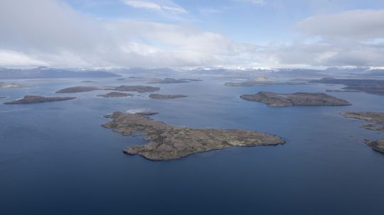
Discovered on 12 February 1772 by the French navigator Yves Joseph Kerguelen de Trémarec, the eponymous archipelago consists of a main island ( Grande Terre ) and nearly 300 satellite islands, all uninhabited. It was in 1893 that the Kerguelen Islands officially became tricolour territories, territories mainly populated by elephant seals, king penguins, albatrosses and other gorfus. Meteorologically, the climate of the Kerguelen is oceanic, icy and extremely windy. The average temperature is 4.5 °C, with a summer at 7.9 °C and a winter at only 2 °C. However, it often rains in the Kerguelen Islands, but not very much, with only 820 mm per year ( against 1,210 in Brest and 515 in Marseille ). On the east coast of the archipelago, because the west coast multiplies this figure by 3. It often snows in this archipelago a snow quickly cleaned by the rain however. If winds of 150 to 200 km/h are frequent, the nearby "howling fifties" cause a permanent wind of 35 km/h, 365 days a year.
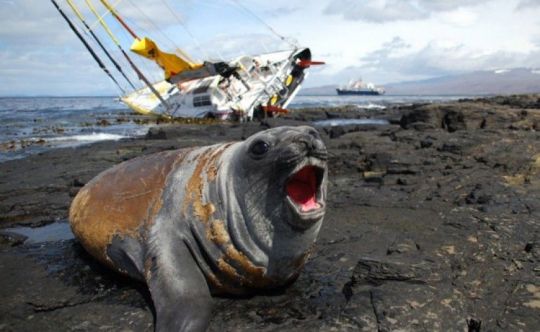
The sea has swell heights of 12 to 15 m in this archipelago, which offers boats numerous shelters that are adequately protected. It was here, in front of the base at Port-aux-Français that Bernard Stamm tried to come to shelter to repair his rudders. Alas, his anchorage slipped and his IMOCA went aground on the bank. He was finally repatriated to Reunion Island in a pitiful state by the Marion Dufresne.
4 - Amsterdam - 37° 50? S, 77° 31? E
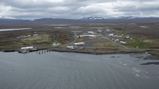
Slightly further north are the islands of St. Paul and Amsterdam. These two islands, which are about 85 kilometres apart, enjoy an oceanic climate where snow and frost are absent in winter, but are strongly swept by constant westerly winds.
Amsterdam, which France finally took possession of in 1892, is inhabited year-round by researchers and meteorologists. It is therefore not worthwhile for sailors to anchor there, especially as they will be welcomed by a fauna composed mainly of sea lions ( Arctocephalus tropicalis ) of elephant seals. In winter the waters may be frequented by sea leopards. In short, an unwelcoming neighborhood.
Saint-Paul - 38° 43? S, 77° 31?E
It is strictly forbidden to land in Saint-Paul, which should not hinder the Vendée Globe racers, who are not allowed to stop over. Saint-Paul is forbidden to enter except for expeditions authorised by the French government in order to safeguard the environment. Then, to know that the last human inhabitants of the island were called the "last human inhabitants" Forgotten of Saint Paul "is enough to confirm the inhospitable nature of the place.
5 - New Caledonia - 21° 15? S, 165° 18? E
To port, but largely to the north, New Caledonia will represent the next longitude share with the competitors. Having become French in 1853, the Kanak archipelago is made up of the 5 main islands of Grande Terre, Lifou, Maré, Île des Pins and Ouvéa. In addition there are 50 to 100 islets scattered throughout the Melanesian space to make up New Caledonia. Under the trade winds, the archipelago enjoys a windy climate with mild temperatures around 20° on average per year. An important notice to solo sailors, the 271,407 inhabitants of the archipelago are likely to make you quickly lose the solitude of the race!
Change of date
It is at this precise moment, geographically speaking, that navigators will change day by crossing the international date line (180° E or W longitude) and switch to west longitude.
6 - French Polynesia - 17° 32? S, 149° 34? W
It is Marotiri, a group of four completely uninhabited islets that will be on the same longitude as the Vendée Globe racers as the next territory dependent on the Elysée Palace. There are obviously no inhabitants on these 4.31 hectares of French territory at the end of the world. The first inhabited island will be Rapa with 515 inhabitants, who will share the 40 square kilometres and is only served by the fleet of Tuhaa Pae Fret 3 to 4 times a year. The fog, often present in Marotiri, will remind the competitors of the start of this ninth edition of the Vendée Globe. If the average annual temperature is 20°C, more than 2,500 mm of water falls each year.
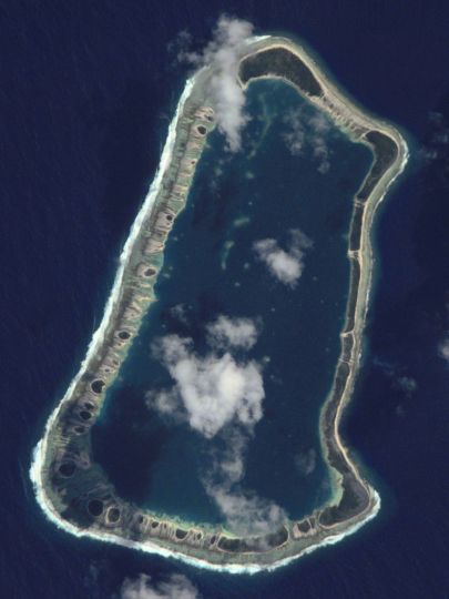
It is at the longitude of Temoe, the least westerly, that the competitors will leave the proximity of the Polynesian archipelago. The last inhabitants having left the island in 1838, the competitors will be solo here as well. The exit gate from the Pacific Ocean for the competitors, who will have to cross a few miles before the tricolour flag will once again fly.
7 - French Guiana - 3° 59? N, 53° 00? W
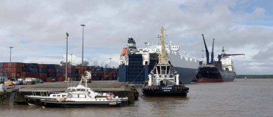
Rounding Cape Horn, heading north. In a short time, they will be at the latitudes of the Guyana coast. Situated just above the equator (3° N) the competitors will have more to do with battling with the doldrums than dreaming of a stopover in French Guiana.
French Guiana has been French since 1763 and borders Brazil for 730 kilometres, making Brazil the country with the largest land border with France. It's in Cayenne that the competitors might want to stop. There is the Port de Dégrad des Cannes, the maritime gateway to the department. In particular, they will be able to come across parts of the Ariane 5 rocket regularly launched from Kourou. The Guyanese climate is humid equatorial with an average temperature of 25.5°C. The average rainfall of 2,816 mm means that it rains more in Cayenne than in Les Sables-d'Olonne (824 mm).
8 - The West Indies - 17° 53? N, 62° 50? W
Continuing their route towards the Vendée, the competitors, who will be thinking of everything but dawdling, will cross the Caribbean latitudes as they enter the Caribbean Sea. Saint-Barthélemy and Saint-Martin will welcome them on this detour from the initial route.
9 - Saint Pierre and Miquelon - 46° 49? N, 56° 16? W
Leaving the West Indies by the North, some could push the avoidance of the Azores High by frequenting the latitude of the archipelago of Saint-Pierre-et-Miquelon (46°N) and its 6274 inhabitants, who became French in 1763.
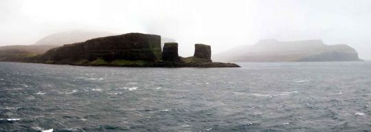
46°N is also the latitude of Les Sables-d'Olonne where the finish line awaits them!

 /
/ 