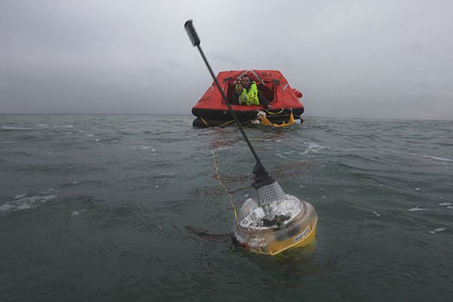
The EPIRB uses the Cospas-Sarsat satellite network. The original network operates with geostationary satellites (GEOSAR) and low-altitude satellites (LEOSAR). With these two networks, the whole globe is covered (even the poles) and an alert is triggered on average in 20 minutes according to the point of the globe concerned. Moreover, if the EPIRB is equipped with a GPS, it transmits its position and the emergency intervention gains in precision and increases in speed
A last generation of tags
McMurdo just launched a new generation of beacon. It uses GNSS receivers and is fully MEOSAR compatible, allowing greater accuracy and faster localization.
GNSS is a positioning system that combines all current systems (GPS, Glonass and Galileo), i.e. 72 satellites instead of the 12 of the GPS system alone. Cospas-Sarsat is currently modernizing its system by placing search and rescue receivers (Rx/Tx transponder receiver) on board the new navigation satellites operated by the United States (GPS), Russia (Glonass) and Europe (Galileo).
This increase in the system considerably improves detection speed and beacon location accuracy. But above all the satellite coverage is greatly increased with 72 satellites still above our heads.
These satellites are placed in orbit around the Earth at altitudes between 19 000 km and 23 000 km, which is considered a medium altitude orbit. This new component of the Cospas-Sarsat System is thus called MEOSAR. It will complement the existing LEOSAR and GEOSAR systems.
An almost immediate alert!
Already effective, the MEOSAR system offers the advantages of the LEOSAR and GEOSAR systems, without their current limits of coverage, by transmitting the distress message and especially by providing its location in a very precise way, with a worldwide coverage in almost real time. We're talking less than four minutes to trigger an alert!
Once fully implemented, the MEOSAR system will also bring further improvements to the Cospas-Sarsat beacons. Now the new EPIRB tags will receive a return transmission that will confirm to users that the alert message has been received. The shipwreck will know then by looking at an indicator light on its beacon that the research is in progress. Until now, the shipwrecker could only visualize that his beacon was en route, but he did not know if the message was transmitted.
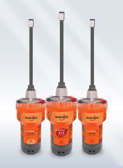
The tag that combines EPRIB and AIS
An EPIRB sends a signal to earth via a satellite. It's very useful if you're offshore, away from other ships. A second signal on frequency 121,5 Mhz is also emitted to ensure the radio guidance of the helpers towards the beacon.
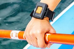
But for coastal navigation or in areas of heavy traffic, it is preferable to trigger an AIS alert that will be received by all vessels in the vicinity. SmartFind G8 AIS combines the two alerts: EPIRB and AIS. Double security in a single device..
- SmartFind E8 Manual without GNSS receiver : 509 €
- SmartFind G8 Manual with GNSS receiver : 569 €
- SmartFind G8 AIS Manual with GNSS receiver : 619 €
