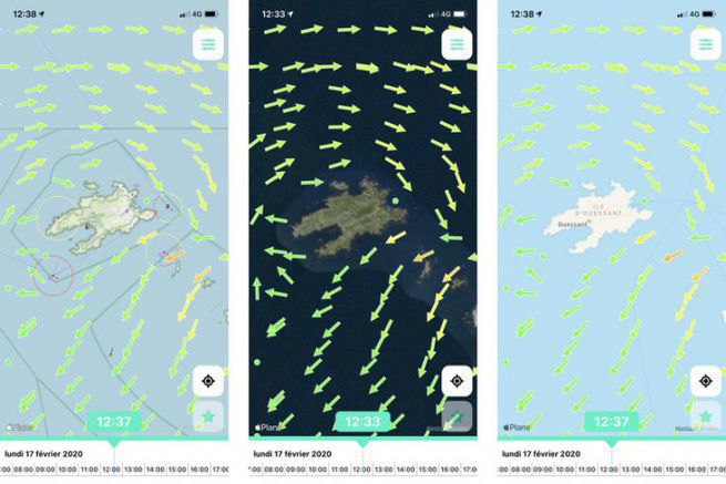
While there are applications for marine weather and tide schedules, the designers of Juzzy realized that there is nothing for currents. The data is available from SHOM, but not easily accessible in our smartphones. Thus was born Juzzy the application of tidal currents for the French Channel and Atlantic coasts. With Juzzy, you know for free and graphically which current you will meet between Dunkirk and Hendaye.

Immediate start up
Available on Apple and Android devices, the interface of this application is crystal clear. You can display 3 different map backgrounds (Open Sea Map with nautical information, Satellite Map with popular photos of fishermen and a standard map background that is very light to display). The current is indicated free of charge at time T. That is to say, at the time the application is consulted. Of course the GPS of your smartphone will locate you on the map.

The current materialized by arrows
By clicking on the current arrow that changes color from green to red depending on its strength, you will get a precise indication of the strength (in knots or km/h) and direction (its heading). There is also an icon in the reference ports to indicate the tide. It's all free! The mesh size depends on the area, but can be very precise for example in the Iroise Sea (the SHOM stronghold).

A very reasonable rate
A subscription is required when you want to know the current (or tidal) forecasts. If you want to know what is going to happen in the following hours to better manage the right edge in the regatta or to understand where the fish will hide when fishing, you will have to subscribe. This is in order to pay the SHOM who does not give its data for free. But this subscription is really minimal since it varies from 1.99 euros for a month to 8.99 euros for the year.

Works even out at sea
The strength of this application is that it works even if you are out of range of the network. All current information is stored in memory in your device. So you can use it even offshore.


